Allen
County Kansas
Maps
ONLINE
NOTE......
Some of these maps are very big
and may take a while to load.
........ taken from a sectional map of the state of Kansas showing the route of
the Union Pacific Railway--E. D. to Denver City. Col. and complete system of
projected rail roads. Once you get to the map and want to return to this page
click on your BACK button. WARNING!! THIS MAP
IS HUGE AND WILL TAKE SOME TIME TO LOAD. (Click HERE to go to an
online collection of maps provided by the Library of Congress of maps from all
over the world. Among the maps you'll find here is the map of Kansas from which
this Allen County section is taken.
1854 Eastman's map of Kansas & Nebraska Territories with Indian Reserves
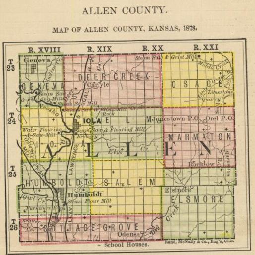
1878 Allen County map
........ from the Kansas State Board of Agriculture's First Biennial Report
(Provided by the Digital Library of the KSGenWeb
Project).
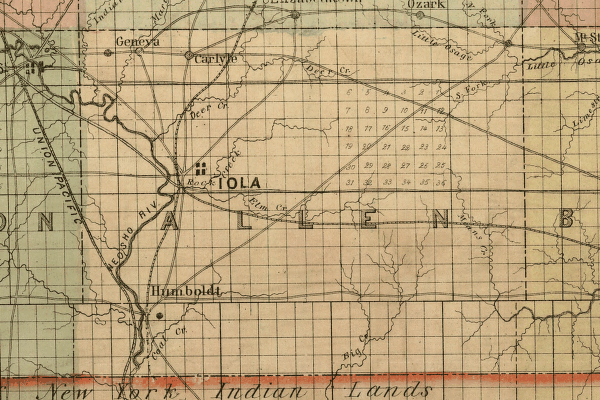
1883 Allen County map
........ from the online edition of William G. Cutler's classic book, History of the State of Kansas
Allen County section of an 1884 Kansas map
........ compiled from the official records of the General Land Office and
other sources under supervision of G.P. Strum. Once you get to the map and want
to return to this page click on your BACK button. (Click HERE to go to an
online collection of maps provided by the Library of Congress of maps from all
over the world. Among the maps you'll find here is the map of Kansas from which
this Allen County section is taken.
Allen County section of an 1886 Kansas map
......... showing the Atchison, Topeka & Santa Fé Rail Road and its
auxiliary roads in the state of Kansas. Once you get to the map and want to
return to this page click on your BACK button. (Click HERE to go to an
online collection of maps provided by the Library of Congress of maps from all
over the world. Among the maps you'll find here is the map of Kansas from which
this Allen County section is taken.
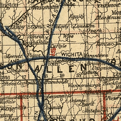
Allen County area of an 1895 Kansas
map
......... provided by Pam Rietsch. Check out Pam's great U.S. 1895 map project
at http://www.livgenmi.com/1895. THANKS
FOR PUTTING UP THIS GREAT SERVICE, PAM! Once you get to the map and want to
return to this page click on your BACK button.
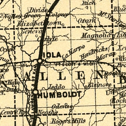
Allen County section of an 1897 Kansas map
.......... one of the Galbraith's railway mail service maps of Kansas. Take
note of the great illustrations on this map. Once you get to the map and want
to return to this page click on your BACK button. (Click HERE to go to an
online collection of maps provided by the Library of Congress of maps from all
over the world. Among the maps you'll find here is the map of Kansas from which
this Allen County section is taken.
1921 Allen County Atlas & Plat Book
Kansas Shaded Relief Map from
the Kansas Geological Survey
Kansas Map Collection at Geology.com
Return to Allen County ALHN main
page
