NEGenWeb Project
Church/Catholic
Franciscans
![]()
![]()
![]() MID-NEBRASKA
MID-NEBRASKA![]()
![]()
![]()
Chapter III
MID-NEBRASKA
The term, "Mid-Nebraska", so popularly known today, includes nine counties which have Platte County for their hub. The other eight counties are Polk and Butler, south of the Platte River, and Colfax, Stanton, Madison, Boone, Nance and Merrick, on the north, east and west. These counties present a natural grouping, inasmuch as they are in the trade region of which Columbus, county-seat of Platte County, is the logical metropolis and the largest city.
PARKMAN WRITES OF THE OREGON TRAIL
When Francis Parkman, the famous historian, left St. Louis in 1846 on a trip along the Oregon Trail, he found it the most peculiar highway in the world. Stretching directly across Nebraska, over the Great Divide, and thence to the Pacific, through the heart of the great region now known as "Mid-Nebraska", the Oregon Trail was very rude in character, and bore no trace of having already carried tens of thousands of people on its bosom. Parkman was perhaps the first man of eminence to note the importance of this route and to return a highly satisfactory report of the land through which the famous trail ran.
The Gold Rush to California in 1849, so relates Parkman in his book, "The Oregon Trail", brought first fame to the highway, as it was soon found to be the easiest route to the promised land. However, no one settled in the region of Mid-Nebraska until nearly two decades later. Repeatedly, military reports indicated the grave danger to pioneers, who were overly-anxious to push the frontiers west at too rapid a rate. The Expedition of Lewis and Clark in 1804 found the Indian tribes then living in Nebraska easy to deal with. But this docility was destined to be short-lived. Subsequent military reports of General G. M. Dodge, General John C. Fremont and a Major Long, all of the United States Army, reported adverse criticism of the prairie tribes. They found the Omahas, Poncas and especially the Sioux, Arapahoes and Ogallalas, a crafty and distrustful collection of lazy vagabonds.
In defense of the red man, though, we must admit, these reports to military headquarters were often considerably exaggerated, to glorify the difficulties encountered by the troops and the commander. The obnoxious title, "The Great American Desert", was a product of Major Long's imagination, placed on the maps he drew, because of disappointments met on the expedition he was sent on.
THE PAWNEES HELP TO BUILD THE OREGON TRAIL
The early surveyors of Nebraska gave the greatest praise to the Pawnee Indians, whose home comprised what is now Mid-Nebraska, for planning the best routes over the Plains to and from their accustomed hunting grounds. A mere following of a Pawnee trail in the early days always resulted in discovering the most logical hard-surfaced lands and the easiest fords. Much of the irregularities of the present-day roads is due to the fact that the first settlers picked out the old Indian trails as the best routes of travel, and adopted them just as the Indians left them. What later developed into the renowned Oregon Trail grew out of a combination of Omaha and Pawnee Indian trails.
SOME INTERESTING NOTES
So popular did this overland trail become that it was soon the longest highway in the United States, and for many years, the chief connecting link between the eastern and western States. In length the Oregon Trail was 2020 miles, and as late as 1843, with myriads of immigrants from every corner of the earth passing over it, there were only four settlements between its two extremes. Along it passed the famed novelist, Washington Irving, writing his "Astoria", a story of the fur dealings of John Jacob Astor. The Grand Duke Alexis of Russia, under the military escort of Generals Sheridan and Custer and the famous "Buffalo Bill" Cody, journeyed along the Trail and hunted buffalo in Western Nebraska and Wyoming.
"The Graves of the Oregon Trail" stretched their mute evidences through Mid-Nebraska, as they did in other parts of the Oregon Trail. The fear of the Indians and the personal hardships precipitated by travel over the rough route took their heavy toll of brave hearts who had given their best-and lost. The acute change in living and the under-nourishment on the Plains
17
![]()
caused the cholera plague to break out, and the Grim Reaper raised graves by the thousands along the Trail. The sight of these countless mounds, marking the last resting-places of luckless immigrants, tore at the hearts of the stoutest pioneers.
A LITTLE PAWNEE HISTORY
Prior to the year 1854, when the Nebraska Territory was formed, all the land west of the Missouri River to the Rocky Mountains was officially closed to white settlement without special Federal permission, it being hoped that this section could be made into an ideal reser-
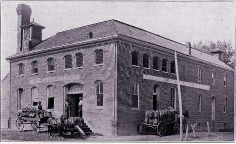
The Bremer-Henggeler, Kersenbrock-Walter, Rambour Brewery, at Columbus, Neb., 1866.
vation for the Indians. The early pioneers disregarded this rule almost from the day it was made. In those history-making years the Pawnee Indians could best be studied in the closely-populated area in Butler County. Ruins of their sod houses constructed about a pole can still be seen near Savanna, one-time, (now extinct), county seat of Butler County.
The Pawnee Indians, well-known early residents of Platte County, were ever at the mercy of the Sioux, their natural enemies. The Pawnee ancestral home was originally along the north bank of the Platte River, but in the hope of
The Wolfel-Krumei home--Oldest House at Columbus (1856 or '57).
more amicable living, four bands of them moved to the south side. The Federal Government had hoped to keep the boundaries of the various tribes intact, and already in 1834 it negotiated for the purchase of these south lands. This was principally done to make way for the influx of white settlers, who were, however, slow in mak-
18
![]()
ing their homes there, as was attested by the sorry rise and fall of Governor Cuming's "Jones county", twenty years later.
THE PAWNEES SURRENDER AT "BATTLE CREEK"
The four Pawnee Indian bands continued to reside in their south home unmolested until 1855, when a final treaty was signed. The Indians agreed to move off, and accepted a reservation containing 300,000 acres in the Loup Fork Valley. So slow were these red men in moving, however, that the United States Army was needed to demand it in 1859. The Pawnees did
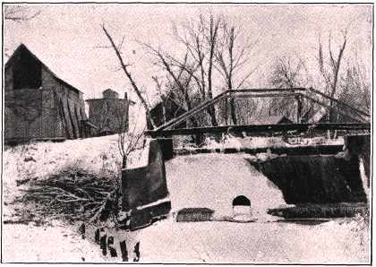
The Peter Schmid Mill on the Monastery Road north of Columbus.
so via Fremont and the Elkhorn River, along which route they plundered what white men's houses they chanced upon. The militia of the Nebraska Territory set out to punish the culprits and met them at a small creek near the present city of Norfolk. Although the Indians surrendered before a shot was fired, the town and, stream are still called Battle Creek.
The Pawnees were not content with their Loup Valley home. They remained there for fifteen years, knowing from the start that they were destined for another move. The Pawnees never worked their fields nor showed any enthusiasm in their new home. The order to move eventually came. Cut to pieces by the ravaging Sioux, to whose country they were now closer, and eaten out by the grasshoppers, the Pawnees were plainly on their Last Long Trail.
Broken as a nation and fighting a hopeless cause, they consented to move far away from their old home. The treaty was signed in 1874. The Indians were not wanted on the rich lands
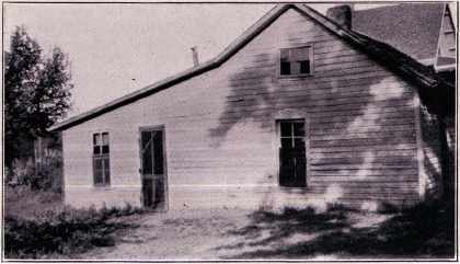
Mathias Fischer Homestead southwest of Humphrey.
between the Platte and the Loup. Their appearance there was an acute setback to the designs of men who wished to claim the fertile country. Accordingly, a small detachment of soldiers transferred the Pawnees to Oklahoma, then known as the Indian Territory. Numbering more than 10,000 when the white men first knew them, the Pawnees answered the roll call with only 653 souls in the last census.
"THE DENVER TRAIL"
When the Mormons moved westward across Nebraska they started from Omaha, continued westward along the north bank of the Platte River to Fort Laramie, passing through Colfax, Platte and Merrick Counties. In the Sixties, however, when the mines of Colorado first revealed their fairy riches, "The Denver Trail' was originated. It followed the route used by the Mormons to the point of the Platte just
19
![]()
three miles north of the present site of St. Mary's Catholic Church, in Luxemburg Settlement, Butler County. Shinn's Ferry was operated here and "The Denver Trail" crossed to the south bank of the river, continuing west along the stream to Fort Kearney, and thence into Colorado. Up to 1869 "The Denver Trail" was a much-used route, and it gave many pioneer families to Butler and Polk Counties. An enterprising gentleman named Hookstra started a ferry east of Shinn's, in 1863, and afforded south settlers the only safe river crossing to the railroad station of Schuyler, then a hamlet of six homes.
WHAT HAPPENED IN BUTLER COUNTY
Butler County's early county seat, Savanna, was doomed to a premature death. When the engineers of the Burlington Railroad went through that district, inspecting the Federal Land grants along the south side of the Platte River, they decided that Savanna was not competent of economic growth, and refused to build their branch railroad that close to the river. They preferred a new site further southeast, and thus David City came into being. The court house at Savanna was moved into David City in 1873, and made a part of the Perkins Hotel. One by one the buildings were removed, some being taken to the new town and others razed for firewood. So complete was the disintegration of Savanna that the only thing remaining now on its site is the cemetery of the four Pawnee Indian bands. The cemetery is merely inclosed (sic) by a fence to keep out trespassers. There are no head stones visible, not even for the few white people buried there.
MID-NEBRASKA'S AGRICULTURAL ASPECTS
Although not exactly history, yet a resume of Mid-Nebraska's agricultural aspects might be acceptable to those who reside in this choice bit of the vast Plains. Most of Mid-Nebraska lies in the rich Platte and Loup Valley districts; the junctions of these two greatest of Nebraska rivers making the soil thereabouts especially favorable for diversified farming. From the close of the Civil War to almost the beginning of the Twentieth Century a giant immigration took place into Nebraska. The first settlement in this section was made at Columbus, near the junction of the two rivers. Farming at once assumed its kingly throne. Manufacturing takes a second position all through Mid-Nebraska.
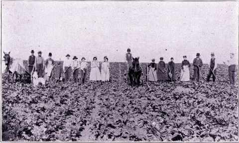
Cultivating sugar beets near Humphrey.
THE EFFECT OF CUSTER'S LAST STAND ON MID-NEBRASKA
The battle between the forces of General Custer and Sitting Bull, fought on June 25, 1876, between 250 soldiers and 2,500 Sioux Indians at a little Indian village 40 miles below the mouth of the Little Horn River, in Montana, and which resulted in the most terrible massacre ever perpetrated on the Plains, is now said to have been a good thing for Mid-Nebraska. This is the reason pointed out: During the decades of the Seventies and the Eighties the Indians in the West were in the death struggle in the prevention of white supremacy, and no outpost of white people was safe at any time. The annihilation of Uncle Sam's guardians themselves on the Little Horn River, even though the actual number of soldiers killed was
20
![]()
small, struck soberness in the eager squatters who kept going further and further West. Taking discretion to be the better part of valor, tens of thousands of these people changed their minds about taking up land in the more western states arid squatted in Nebraska instead. Here their lands were closer to the larger cities, there were several forts still in existence, and safety was much more secure.
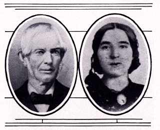
Mr. and Mrs. John Browner, first Catholic settlers at Columbus.
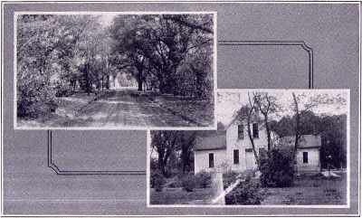
The John Browner Home northeast of Columbus.
HOW THE PEOPLE SPREAD ABOUT IN MID-NEBRASKA
Some of these people located west of Columbus, and for a time squatted about Hartwell Settlement. James Vieregg homesteaded first in the country now included in Merrick County. An abundance of German and Irish followed in his wake. Hundreds of Poles chose this place for their final settling place, and today Mid-Nebraska is probably the heaviest Polish sector in the State.
Germans and Irish flocked northward from Columbus and in June, 1866, L. D. Barnes, William H. Bradshaw, D. L. Allen, William A. Barnes, and Mathias Carr first settled in what is now Madison County. This County was officially organized in 1868 with the county-seat one mile west of Norfolk. In 1875, however, pressure brought the county-seat to Madison, where it has since remained. Norwegians, Swedes and Bohemians followed the first Madison men. Many of these later preferred Stanton County, and there are now found large numbers of Bohemians and Irish in Stanton and the north portion of Colfax. A large influx of Swiss immigrants chose the district immediately around Columbus, running as far west as the Merrick county line.
21
![]()
THE TWO BEST KNOWN FERRIES
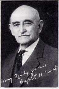
In the early days, long before the farmers in the Scottsbluff district conceived the idea of irrigation from the Platte, this river was a dangerous stream. It was always unfit for navigation, as was testified by the numerous sand-bar wrecks of river boats. The Loup, racing across all the western and central parts of Nebraska, was likewise a treacherous river. The best known ferry on the Platte was Shinn's Ferry, constructed in a clearing of underbrush between Schuyler and Columbus. It was owned by Elder Shinn, a hard working Mormon evangelist and one of the richest men in Omaha in his time. Shinn did not operate his ferry himself, but hired a man to do it for him. Probably the best known Loup ferry was at Columbus, conducted for a long time by a popular figure about Columbus, one Captain John Hammond. Outside capital usually furnished the means by which most of the western ferries were started.
Another place of great use to the immigrants was the famous Russell Ranch, five miles west of Schuyler, operated by John Russell, an eccentric old Englishman, during the Sixties. As many as one hundred travelers were known to have stopped at Russell's in a single night. The ranch was a popular meeting place in the early days, and many were the stories swapped around the camp fires there.
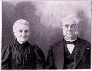
Mr. and Mrs. Henry J. (Sarah) Hudson. Mr. Hudson
was born in London, England, in 1822,
and came to Columbus in 1857.
Minister of Latter Day Saints
Church, Judge, Postmaster
and Writer.
THE FIRST COUNTY FAIR IN MID-NEBRASKA
To show their appreciation of the good progress evidenced by the farmers of Mid-Nebraska, the First Annual Platte County Fair was held Thursday and Friday, October 7 and 8, 1875, by the merchants of Columbus. This was the first fair held within the district now covered by Mid-Nebraska. The fairgrounds were a quarter of a mile from the town limits of Columbus, on a strip of land owned by the elder Fred Gottschalk, now deceased. A building called Floral Hall was erected and a large array of vegetables and grain, and some fruit, was displayed. The live stock exhibit was appreciable. It must be remembered that the Fair was held during the first grasshopper plague, and much of Platte County's vegetation had been destroyed by the pests. Undaunted, the farmers brought in what they saved.
A main feature of the Fair was a baseball game between the Lightfeet team from Boone County and a nine from Columbus. The contest must have been a healthy foot race, as is evidenced by the Boone County boys going home with the Plattsmen scalps with a score of 29 to 25. Rain fell on the first day, but everyone in all the country around took in the novel event on the second, a very pretty day. The Columbus Concert Band furnished music.
The Platte County Fair existed with varied success for many years. The last semblance of a Fair was discontinued shortly before America's entrance into the World War.
THE MID-NEBRASKA EXPOSITION
The Mid-Nebraska Exposition, intended to glorify all the counties bordering on Platte County, was originated in Columbus in 1922, at the suggestion of Charles Fricke, manager of Pollock's Drug Store, and Lloyd Swain, then Advertising Manager of the Columbus Daily Telegram. A unique system of store window displays and "Dollar Memberships" to pay expenses, besides many new innovations too detail-
22
![]()
|
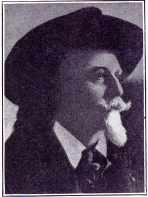
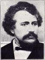
Buffalo Bill (Wm. Cody), Pioneer Scout. |
|
ed to mention, were worked out by these two men. In short, while the Exposition has been in existence, there have been secured national and sectional speakers and aggregations of first prominence. So successful has the new fair idea become that it has drawn editorial comment by the Chicago Tribune and certain eastern dailies, as well as all of Omaha's newspapers. The Mid-Nebraska Exposition Association was properly organized in 1923 and was soon endorsed by civic groups, such as the Lions, Rotary, Commercial Clubs, and Chambers of Commerce of Columbus and surrounding towns. |
A NOVEL METHOD OF EARLY ADVERTISING
An early method of advertising was by means of the curio business. The proximity of the Pawnee Indians gave rise to the collection of Indian relics. This enterprise assumed big and profitable proportions. Many agents went among the Pawnee bands, buying from them their fanciest handiwork. Curios of every description found their way to the offices of these collectors, who, in turn, sent them East, or sold them to the whites of this district. Perhaps the best known of these Pawnee agents was L. W. Platt, who maintained a curio shop in Columbus for many years. Mr. Platt received most of his products direct from the Indian Reservation at Genoa, from which place he also secured the services of several squaws to tan buffalo hides. In the summer of 1874 Platt shipped a carload of dressed buffalo robes east. These hides had been collected in the State by Pawnees and a great number of them were made up by Platt's helpers in Columbus. At the time these robes were shipped they were considered one of the
Geo. Francis Train, Financier |
James Henry Galley. Resident of Columbus |
23
![]()
most valuable foreign shipments made from Nebraska, and there was much comment on them at the time. Untold advertising for Nebraska in general was secured by the Indian curio business.
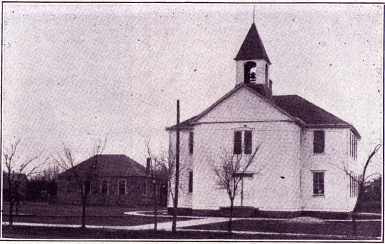
Old School at Monroe. Nebraska.
THE GROWTH OF MID-NEBRASKA
The section of Mid-Nebraska came into its own with the advent of the Twentieth Century. The final defeat of the Sioux in 1890 erased the last fear of red invasion on the white settlements. The grasshoppers, so destructive through the preceding thirty years, were now gone. The severe snowstorms and blizzards, taking their too-often toll of livestock and human lives as
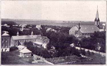
Bird's-eye View of Humphrey, Nebraska.
well, were passed. As early as 1874 the year's homestead grants given at Columbus amounted to 1,481, totaling 170,845 acres, a great deal of which was Platte County land. People took new heart; the day of "grasshopper bread", an article to eat, actually made from grasshoppers, was gone forever. Homesteads increased, communities took on collective life, and the era of prosperity was finally ushered in.
24
![]()
|
|||