NEGenWeb Project
On-Line Library
| 226 | NEBRASKA HISTORY MAGAZINE |
The Case for Kansas
Full Report of Special Committee Kansas Historical Society-1926
Says Kansas Monument is on True Site
Adopted Oct. 19, 1926, by Kansas Historical Society Board
PIKE'S PAWNEE VILLAGE
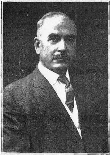
Report of Chairman George P. Morehouse
Where did Lieut. Zebulon Montgomery Pike order the Pawnee Indians to haul down the Spanish flag, and first raise the Stars and Stripes on what is now Kansas soil? During the past year some of our Nebraska historians have been trying to show that the site marked by Kansas in 1901 is not the place where Pike met the Pawnees in 1806 and caused that interesting ceremony to take place.
The Kansas "Pike's Pawnee Village" is a few miles west of Republican City in Republic county, Kansas, and near where White Rock creek joins the Republican river. The accredited site of this old Indian town is on and near a sightly promontory overlooking the valleys of the creek and the Republican. Some of our Nebraska friends have set up the claim that the true site is about twenty-five or thirty miles northwest and near Guide Rock, Webster county, Nebraska. There seems to be the remains of an old Indian village at that place, and from which they have taken some relics of various kinds.
In 1901 Mr. and Mrs. George Johnson, of White Rock, Republic county, Kansas, gave to the state of Kansas eleven and two-tenths acres, being the site of the old Pike's Pawnee Village, as understood at that time by most Kansas and national historians and archaeologists. The state accepted the gift, and by an act of the legislature, approved February 14, 1901, appropriated three thousand dollars to suitably fence and mark the land.
Under the authority of these terms, the Kansas State Historical Society spent of the appropriation $1,150 in fencing six acres of the tract with an iron fence, and $1,750 in erecting
William E. Connelley, Secretary Kansas Historical Society.
226NEBRASKA HISTORY MAGAZINE |
227 |
a Barre, Vt., granite shaft twenty-six feet high. Upon the base of the monument the following inscription is carved:
ERECTED BY THE STATE OF KANSAS
1901
To mark the site of the Pawnee Republic, where
LIEUT. ZEBULON M. PIKE
caused the Spanish flag to be lowered
and the flag of the United States to be raised,
September 29, 1806.
Two large historic demonstrations were held at or near the monument, the first when the corner stone was laid, July 4, 1901, and the second upon unveiling the monument on the anniversary of Pike's visit, September 30, 1901, the 29th being Sunday. These meetings were well attended and several prominent Kansas men and women delivered addresses. Regarding these events volume seven of the Kansas Historical Collections devotes over fifty pages under a chapter "Kansas and the Flag."
On September 26 to 29, 1906, there was a four-days' celebration, the centennial of Pike's Pawnee Village, under the auspices of the Pawnee Historical Society. Governor Hoch was present and made an address, as well as numerous other prominent Kansans. While it included an historical day and a Grand Army day, it seemed that the women's organizations of Kansas almost captured the affair to promote sentiment for woman suffrage.
However, it was a great success, and the tenth volume of Kansas Historical Collections devotes about 150 pages to the centennial and to the numerous addresses, in a chapter entitled 'One Hundred Years Under the Flag."
Only a few of the addresses and papers at these three demonstrations dwelt upon the proof that the Pawnee Republic Village site, in Republic county, Kansas, was the place that Pike had his flag incident with the Indians. It seemed to have been considered a settled matter that the spot that the state had marked, and where these celebrations were being held, was the correct place; and even representatives (sic) from Nebraska were present and took part in the ceremonies.
It is now very strange that, after twenty or twenty-five years' silence, our Nebraska friends should become so enthusiastic in
| 228 | NEBRASKA HISTORY MAGAZINE |
trying to take from our Pike's Pawnee Republic Village its halo of glory.
A few days ago it was my privilege to visit this historic spot and from "the lay of the ground," and after studying Pike's daily journal of his travels through what is now Kansas, I feel that the proof is almost conclusive that our state marked approximately the right spot when it erected the monument. The distances traveled each day, description of the country traversed, the streams crossed and the camping places described by Pike all seem to bear out this conclusion.
The distance to the Nebraska village, near Guide Rock, in Webster county, is too far north to tally with Pike's travels and descriptions. While I think it was from the sightly bluff promontory near our Kansas monument that Pike viewed the village of the Pawnees, the main part of the town, at that time, was on the lower ground eastward and near the fine woods and water of the Republican river. Both Pike and his assistant, Wilkinson, described the village they visited as being at the bottom of the high point. Pike says: "When we arrived on the hill over the town, we were halted," etc. And again he says: "Finding our camp not eligible, we moved it on to the prairie hill, about three-fourths of a mile nearer the village, and pitched our camp on a beautiful eminence, where we had a view of the town and all that was traansacting (sic)." In another place, he says: "We viewed the village from a hill overlooking it."
I think that our friends, during the celebration, stressed too much upon the well-defined circles on the promontory near the monument, as the location of the village Pike visited, when his descriptions seem to place it at the bottom of a hill. These rings up on the table land of the bluff cover several acres and are well defined and as plain as "last-year circus rings," as they have been called. They have been made, probably, since 1806, the date of Pike's visit, and between that date and 1832, when the Delaware Indians burned and destroyed the large Pawnee Republic village, according to the records. At that time the Pawnees were driven further north and likely the Guide Rock village up in Nebraska then became their capital and leading town. It must be remembered that the Pawnees at that time were a very
The Editor of this magazine was present at the Kansas Monument Dedication and expressed at that time his doubt whether the true location had been found. This doubt was reiterated by him on page 30 of his book "History and Stories of Nebraska," first edition published in 1913. This doubt waited for its fulfillment until 1923 when Mr. A. T. Hill discovered the true site--Editor.
NEBRASKA HISTORY MAGAZINE |
229 |
numerous tribe, from ten to twenty thousand warriors, and occupied more than one village.
These rings may have been made, or some of them, by other Indians who occupied the place after the Pawnees had abandoned it. We often find that an advantageous site for an Indian town is often used as such for ages, and the relics found often represent different cultures and nations widely separated in point of time.
Now the question arises, was there ever an Indian town at the foot of the elevation such as Pike describes? From the situation of bluff, woods, water and river, I would say yes, and it also seems that there is and has always been evidences of one on the lower ground, such as Pike described, and where, according to custom Indian villages are usually found, on the lower slopes near water, and where there would be some protection from winds and storms. Rarely, if ever, old Indian village sites are found up on exposed hills and bluff elevations.
Charles S. Scott, about the time of these Pike's Pawnee Village celebrations, and at that time mayor of Cassville, Mo., wrote an interesting paper upon the matter. He was the son of Dr. J. Z. Scott, and with his father's family settled near this old village, which he visited many times back in the early seventies, and before the original surface of the place had been disturbed other than by the work of the Indians.
In his paper, found in the seventh volume of the Kansas Historical Collections, Mr. Scott shows that the real old village, such as Pike described, was at the foot of the bluff and down to the timber of the streams, which, as I have before said, would have been the natural location for an Indian town. Mr. Scott, among several things, says:
"What is known as the Pawnee Village is located on a promontory about one-half mile west of the Republican river and the same distance south of White Rock creek, in Republic county, Kansas. The actual site of the village was on the lowland that lay between the base of the promontory and the Republican river, and the point on the high land above was used as a cemetery.
"My attention was first called to this now interesting place in 1872. At that time little had been done that would obliterate any mark left by the former dwellers of the place. On the high land, the ridges thrown up by the squaws, where they planted
| 230 | NEBRASKA HISTORY MAGAZINE |
their corn for the use of tribe, though sodded over, were yet dnstinct (sic), and now and then a thin slab of flint could be found with which the weary toilers of former days had cultivated the soil. At another point on the promontory could be seen a great number of circles thrown up in the sod. These circles were of various sizes; the smaller ones were from ten to twelve feet in diameter inside, while some were as large as sixty or seventy feet. All appeared to be scooped out in the center, the earth being thrown up so as to form an embankment about eighteen inches in height and three or four feet across. There were no depressions on the outside of the circles. All were sodded over and silent witnesses of the industry of the builders. (Mr. Scott's description of these circles is a perfect representation of them at the present time, where the land in the monument inclosure has not been cultivated.)
"It was said that these embankments, rings or circles had been thrown up by the Indians as a protection to their tents, but examination of the circles proves the contrary. In all of them, whether large or small, there repose all that is earthly of this one-time independent and powerful people. Here on this bold headland, swept by the fierce blast of winter from the north, and kissed by the first balmy breeze of spring from the south, was given back to Mother Earth, with tender, though savage hands, with breaking, though untamed hearts, all that remained of those they held most dear. The brave warrior who defended his home and tribe against the foes that beset them, and who met death while engaged in this glorious duty, lies sleeping beneath this headland's verdant sod. The aged chief whose days were numbered, and who was gathered to his fathers, the youth, the child, all lie here sleeping that sleep that shall have no end. Here, on this slanting hill, where the first rays of the rising sun call forth the lark to cheerful song, and where the declining sun casts his beams while all else is wrapped in shade, they sleep. It is fitting that this place should be marked by a monument, and upon it in boldest type, and in the best work of the sculptor's art, the glory of Pike should be presented to all who may read. Yet on one small tablet should be inscribed in fitting words some inscription sacred to the memory of those who lie sleeping here awaiting the final call.
Village at Foot of Hill.
"At the foot of the hill, in 1872, and for several years after, could be seen the marks left by the Indians, where they had their village. Their camp fires could be located by the presence of coal mixed with earth, rock, broken pottery, pieces of cast cooking utensils, etc. Many of the larger trees showed the effects of the tomahawk. In some of the larger trees, in which cavities existed, were found the implements peculiar to the tribes of the early days. In one were found the parts of an old flintlock musket and some rude lead bullets. My father, Dr. J. Z. Scott, located at a point south of the place, and for several months my brother, Frank M. Scott, and myself devoted a great deal of
NEBRASKA HISTORY MAGAZINE |
231 |
time exploring it. From the circles we took many articles, such as beads, stone hatchets, pipes, tomahawks, etc.; also great quantities of bones. In the eastern part of the grounds, where burials were made, there would be two depressions in the sod, with a ridge between. We supposed that probably prominent members of the tribe were buried in these places. The larger circles were at the eastern end of the ground, and were complete. As the grounds extended westward the circles decreased in size, and some of them were incomplete, showing that the circles were not made complete at once, but were extended as interments were made, until the circles were complete, when another would be started."
Mr. Scott then closes his description of the Old Pawnee Village as follows: "I am aware that the position I have taken, both regarding Pike's camp and the location of the village, is different from that taken by others who have written much on the matter, but I have this to say: That the account of Pike's travels through what is now Jewell county, as given in his memoranda, supports my claim. His mention of the 'old road,' and the distance, as he states (twelve miles), would locate him on Big Timber creek, and to the west of the road. Last, his arrival at a 'hill overlooking the village,' locates the village on the Republican river, below the promontory."
While Mr. Scott presents valuable evidence as to the location of Pike's Pawnee Village, and may be right in his idea that the well-known circles on the promontory flat at the monument inclosure are the places of their graves, I am not yet prepared, without further personal investigation, to subscribe to that opinion. Doubtless, according to the usual Indian custom, they buried their dead up there on that higher ground; but without further proof, it would seem improbable that all of those many well-known circles are the remains of a cemetery. Some of them seem to be the groundwork of circular Indian lodges. This matter can be definitely determined by proper excavations. But whether they were or not, most of them must have been constructed subsequent to Pike's visit, else he would have mentioned them.
As before stated, our Society only fenced six acres of the tract given, thus leaving five and two-tenths acres outside of the iron railing, as now inclosed. The entire tract should be fenced, for in the course of years, when a few generations pass, adjoin
|
© 2004 for the NEGenWeb Project by Ted & Carole Miller |
||