Photographs by John Wright, Staff Artist.
SCOTTS BLUFF AND VICINITY
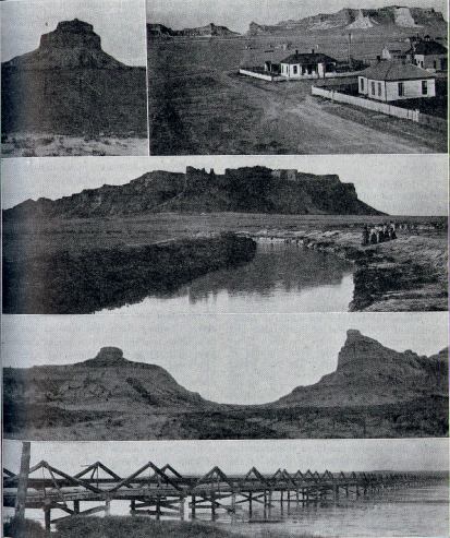
Scotts Bluff, the most imposing in appearance of all the elevations in the Platte valley, is three miles south of the town of that name and two miles west of Gering. The upper and next to the lower pictures show the Bluff, the Tower, and Mitchell's Pass, the route of the Oregon trail between them, looking west from Gering. The upper picture on the right was taken at midnight by the light of the moon, after an exposure of an hour and a half (photo by H. A. Mark). To the left of it is the Tower alone. The second Picture from the top is a view of the Bluff from the east side, an irrigation canal in the foreground. At the bottom is the bridge at Camp Clarke, built in 1876, for the Black Hills traffic, by Henry T. Clarke with the aid of other enterprising citizens of Omaha, leading freighters, and the Union Pacific railroad company.