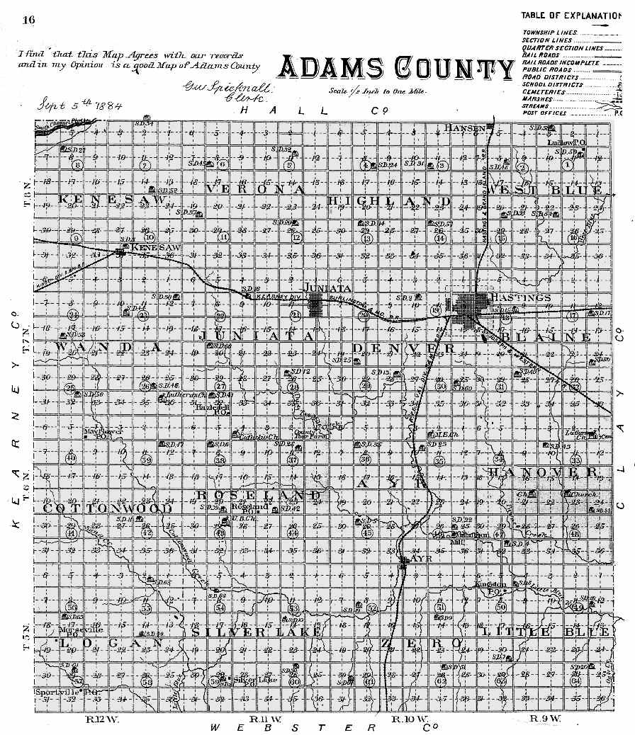
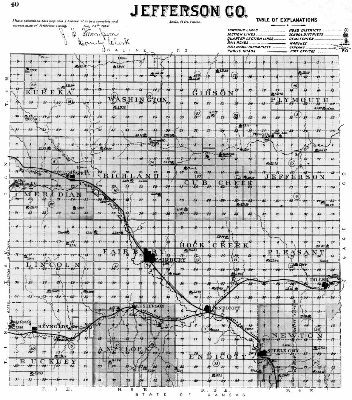
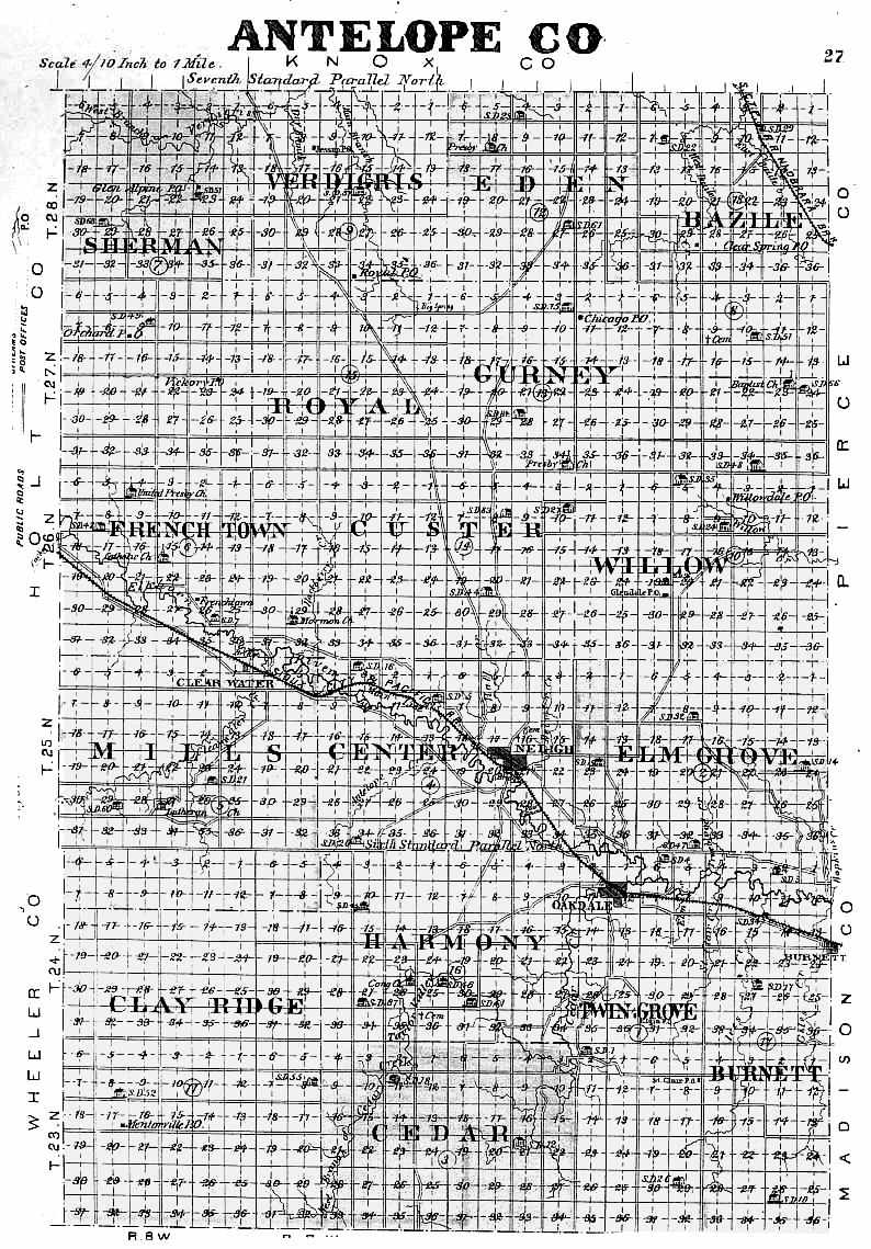
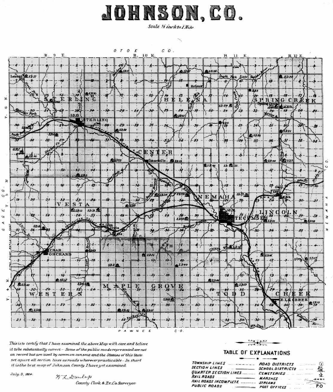
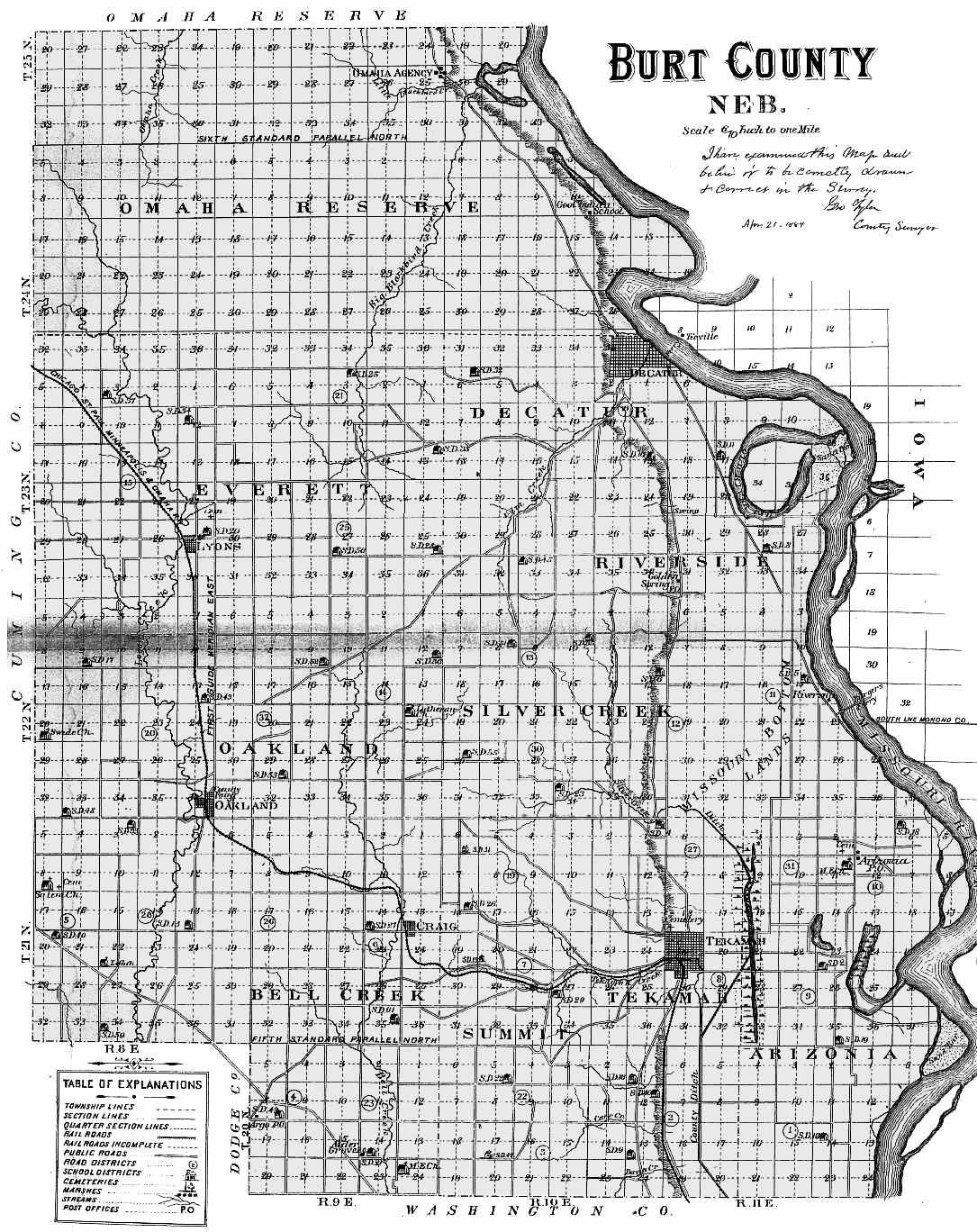
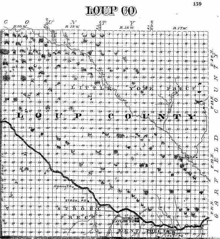
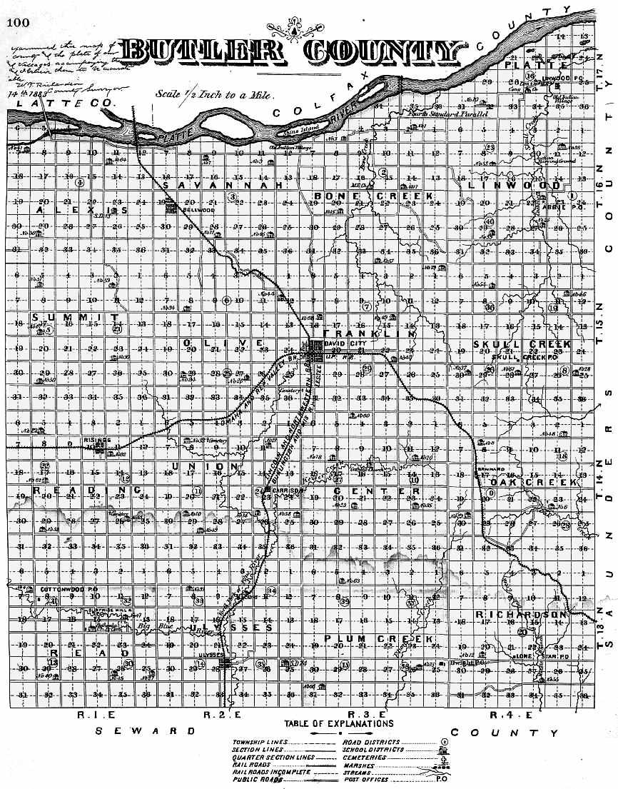
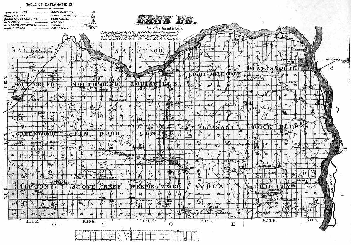
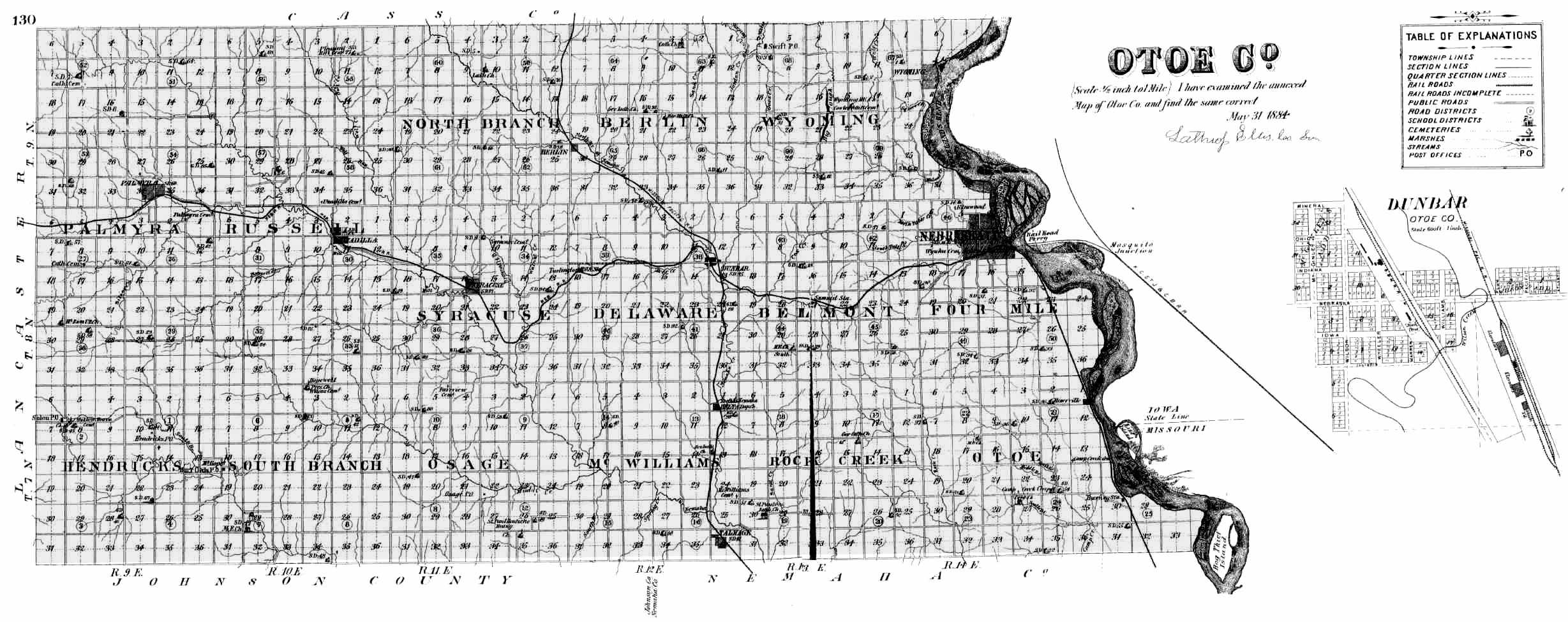
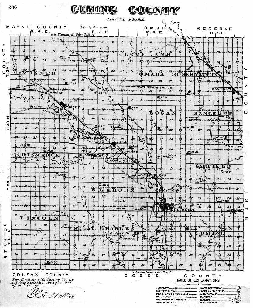
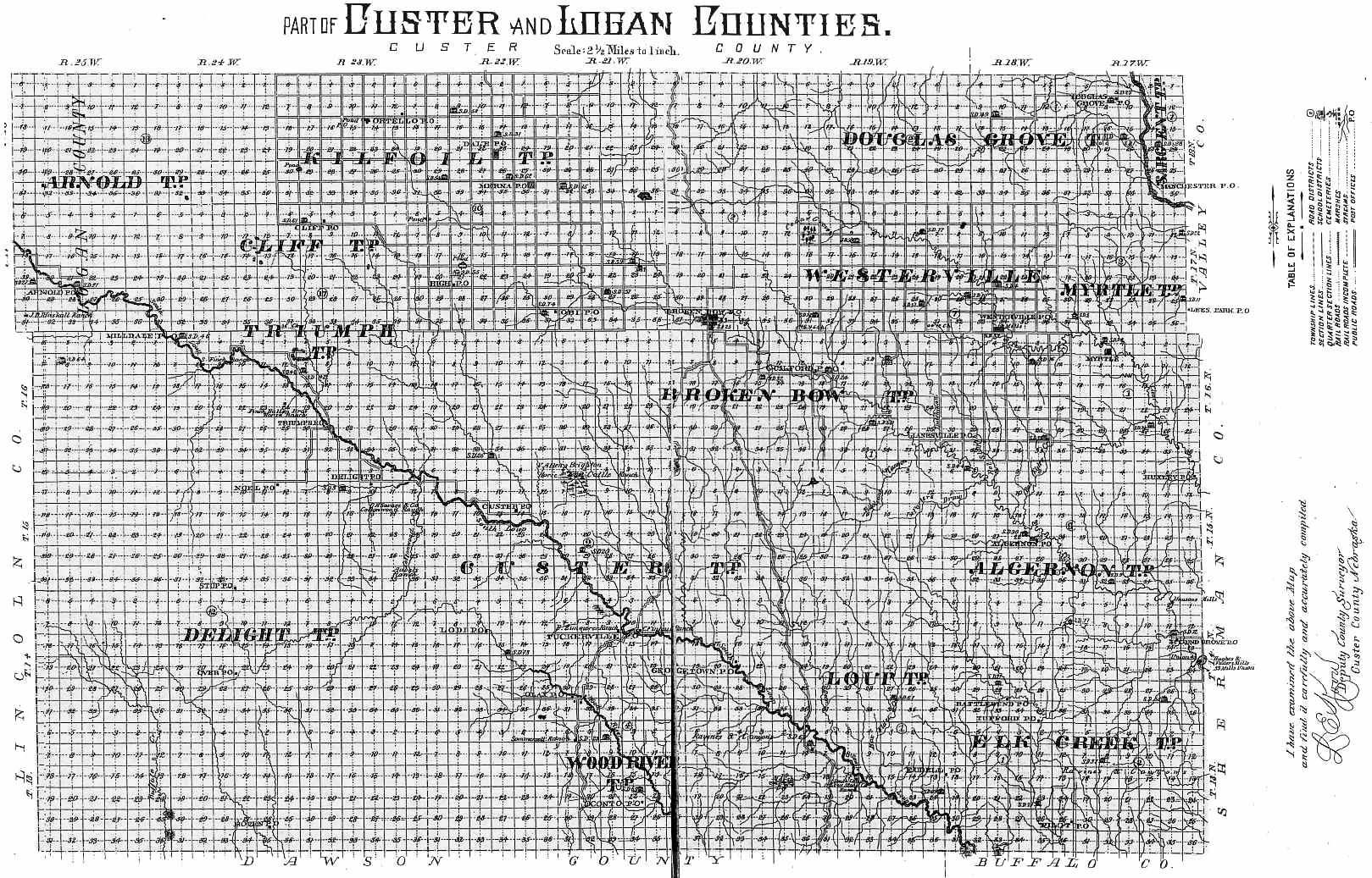
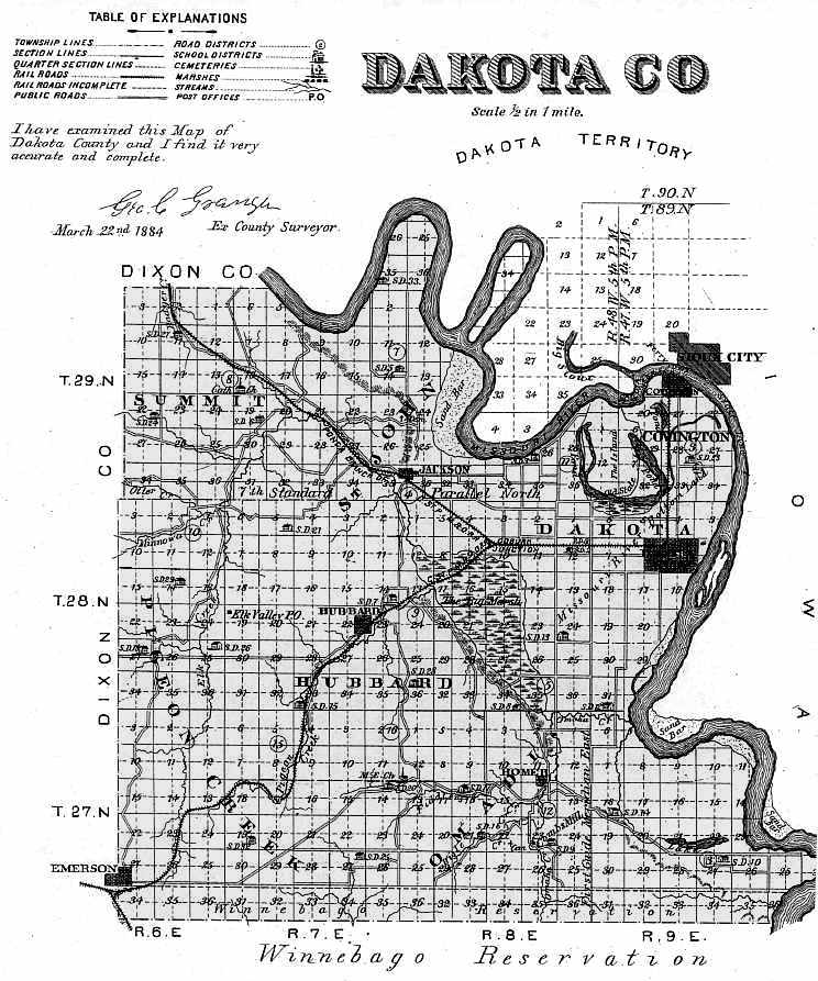
from the
1885 Nebraska Atlas
|
County |
Map Size |
County |
Map Size |
|
|
216K |
251K |
|||
|
226K |
216K |
|||
|
Arthur* |
271K |
|||
|
Banner* |
316K |
|||
|
163K |
428K |
|||
|
241K |
Kimball* |
|||
|
Box Butte* |
315K |
|||
|
Boyd* |
576K |
|||
|
428K |
462K |
|||
|
355K |
99K |
|||
|
311K |
138K |
|||
|
226K |
233K |
|||
|
226K |
McPherson* |
|||
|
229K |
444K |
|||
|
398K |
Morrill* |
|||
|
756K |
206K |
|||
|
908K |
320K |
|||
|
159K |
227K |
|||
|
143K |
327K |
|||
|
182K |
275K |
|||
|
410K |
Perkins* |
|||
|
134K |
241K |
|||
|
548K |
210K |
|||
|
315K |
339K |
|||
|
Deuel* |
257K |
|||
|
223K |
232K |
|||
|
247K |
275K |
|||
|
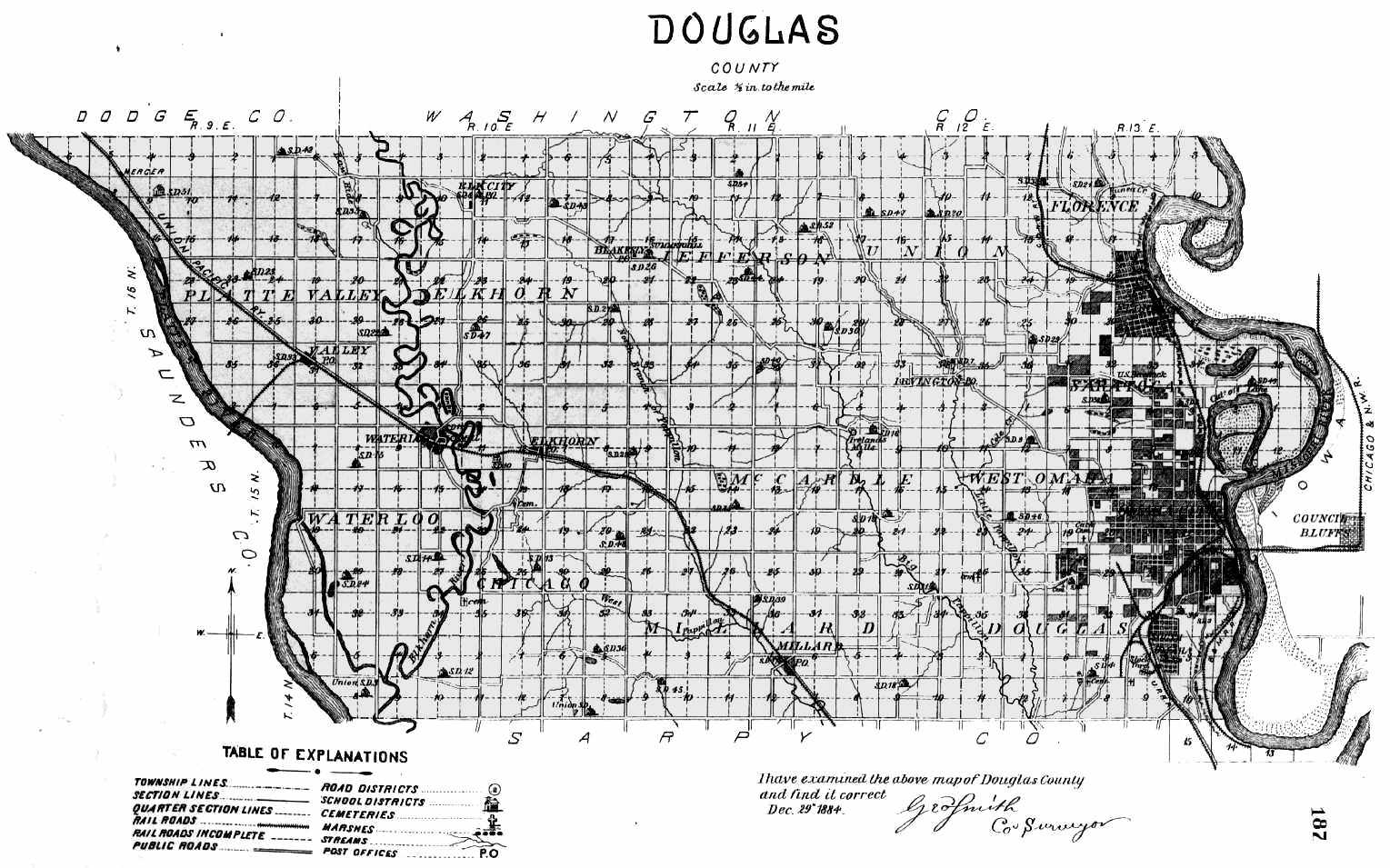
Douglas |
224K |
Rock* |
||
|
398K |
241K |
|||
|
261K |
158K |
|||
|
211K |
338K |
|||
|
248K |
Scotts Bluff* |
|||
|
210K |
268K |
|||
|
358K |
489K |
|||
|
Garden* |
269K |
|||
|
375K |
568K |
|||
|
159K |
174K |
|||
|
Grant* |
243K |
|||
|
270 |
Thomas* |
|||
|
363K |
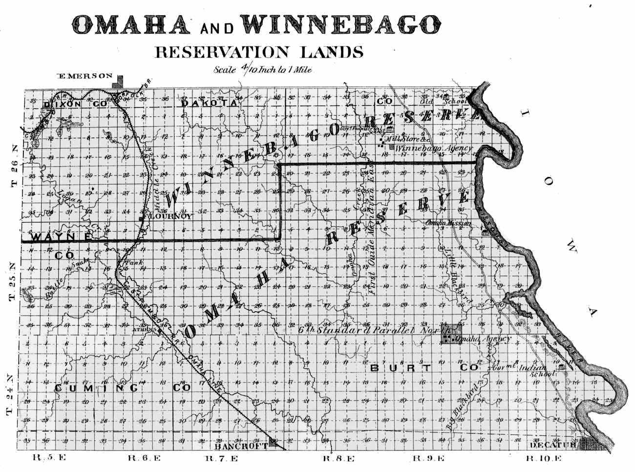
Thurston* (Omaha & Winnebago Reservations) |
193K |
||
|
428K |
640K |
|||
|
420K |
250K |
|||
|
398K |
319K |
|||
|
398K |
228K |
|||
|
463K |
283K |
|||
|
Hooker* |
375K |
|||
|
278K |
260K |
* Not Organized in 1885

© 2000, 2001 for NEGenWeb Project, Nancy Beach, Ted Miller