|
FIRST SETTLEMENT OF THE SCOTTS BLUFF COUNTRY BY GRANT L. SHUMWAY As far back as 1845 some Mexicans came
up from Santa Fe and started agriculture in the North Platte
valley, in the immediate vicinity of Fort Laramie, but with
indifferent success. The climate and soil of the almost
primitive wilderness seemed unfitted for the arts of
domesticity, for the same soil and geographical location
yield abundant return to the frugal husbandman today. |
The Chimney Rock station was about ten miles west of the present site of Bridgeport. The Scotts Bluff station was about five miles east of the famous bluff or mountain. In 1871 this site was appropriated by Mark M. Coad. The other station referred to was on lower Horse Creek. In 1873 John Sparks built a sod house on lower Horse Creek, a little northeast of the old stage station there. The Red Cloud agency was then situated where the "Lower P. F. Ranch" was afterward located, and when Mr. Sparks built the ranch house he was prepared to fight Indians if occasion required. This house was 24x26 feet inside, with walls 30 inches thick. It had three windows, with plank shutters, and a door of like material, all from a sawmill in the Laramie Mountains. This was the same mill which supplied so much material for the buildings of Fort Laramie. The floor and roof boards were double, and the latter were overlaid with several inches of dirt. There were four portholes in the walls, one on each side, made in the manner of an hourglass in a horizontal position, to give a wide range of territory in case of Indian attack. We have no record that the house was ever attacked. The old soddy is now in ruins, although some of the material, including a part of the lumber, is owned by L. J. Wyman, owner of the land on which the building was situated. Mr. Wyman says that "at this point the trail leaves the bottom and heads for the Robidoux Pass."1 He refers to it as the "Oregon Trail." There was a post office called Little Moon established in this sod cabin, and the building was soon enlarged to make room for it and the ranch hands. William Lancaster 1 This name is commonly spelled both Robidou and Robidoux, though the better usage among authors is to leave off the x. Miss Stella M. Drumm, librarian of the Missouri Historical Society, has recently written me the following information touching the spelling of the name which seems conclusive: All members of the Robidou family here spelled their name without the x. I think one reason that you frequently find the name with the added x is due to the fact that the father, Joseph Robidou, his |
was the first postmaster. He moved to the eastern part of the state in 1873 or 1874, where he went into the drug business. The house faced the southeast, and Mr. Sparks had about two acres surrounded by sod walls three feet thick and five feet high. He also fenced in a meadow of about 160 acres with wire; a part of this fence still stands after forty years. The ranch was sold to W. C. Lane and Thomas Sturgis in 1876, Mr. Sparks moving to Nevada, where he became governor.2 While here he owned a valuable riding horse which he kept for his wife who loved to ride the great prairies. After his departure the horse was in charge of Jim Shaw, "Fiddler" Campbell's "buddy", and was kept at the Circle Arrow east of Kimball, then called Antelopeville, and at the Circle Block on the head of Pumpkin Creek. Once S. J. Robb, foreman of the Circle Block, was riding "Old Fox", as the horse was called, when he ran on to a bunch of wild horses. Old Fox so quickly overtook them that Robb did not have time to use his lariat; but he seized one by the tall, hindering the beast so that another cowboy following on a slower horse roped and captured it. A little before and after Jim's trouble over the Collins shooting affair at Camp Clarke bridge, the horse was in care of Chris Streeks, and Old Fox became my wife's favorite riding horse. He was of such a fine spirit that sons, Joseph Jr. and Francois, used a flourish when signing their last name which gives one the impression of a final x. Miss Drumm sent the following tracing of an actual signature of Francois Robldou:  2Mr. Sparks was elected
governor of Nevada in 1902, as a "Silver Democrat". He
assumed the office in January, 1903, but died in 1906,
before the expiration of the term of four years.--ED. |
after getting settled in Nevada Mr. Sparks had him shipped to that state. In 1882 L. J. Wyman came to this country and went to work for Lane & Sturgis. He made his home in the famous old soddy for many years. He now owns the place and lives nearby and has the distinction of being one of the very first of the permanent settlers of the county. Charles Foster came about the same time; and Perry Braziel, a Texan, who "met up" with old "Shanghai" Pierce at Coffeyville, had drifted "up the trail to the North River" in 1880, and he went to work for Mark M. Coad in 1882. These men became permanent settlers of the county and are still residing here. I see I neglected to describe the Coad ranch house. It was built for the Pony Express, facing the south, was 20x5O feet, with walls 30 inches and the sods 8 or 10 inches thick, cedar cross logs and ridge poles, and poles and dirt for the roof, which was supported by a row of posts across the center of the structure. It contained two rooms, the smaller, 12x20, being a kitchen. A large sod fireplace added cheer to the other room. R. C. ("Fiddler") Campbell, W. E. ("Sandy") Ingraham, and George Marsh were the next to "cut loose from the range" and settle down on Scotts Bluff county soil. They built their log cabins on the south side of the river in the fall of 1884, Campbell near the old Coad ranch and the other two in Mitchell valley near the Bay State. In the spring of 1885 each of them broke about ten acres, as an indication of good faith as claimants under the preëmption law. Ingraham was kicked to death by a colt, Marsh has lately removed to Montana, and Campbell yet resides on the original homestead, his first log cabin being a part of his present commodious and comfortable bungalow. In the spring of 1885 "Sailor Joe" Hanson built a log domicile in Mitchell valley and resided there until recent years, or until his boy met a terrible death by being |
dragged over the prairie by a runaway saddle horse. Sandy Ingraham roped the runaway, but the boy was dead. In the summer of 1885 many new people came. In the latter part of August, Albert W. Mills, who lately died, came up the river and settled on the north side, about five miles southeast of the present city of Scotts Bluff, when he immediately commenced the erection of a sod house. He plowed the first furrows on the north side of the river in Scotts Bluff county, with an old "grasshopper" breaker, and was the first of the granger class of citizens in the county. On September 10, Wellington Clark, C. D. Purdy, Joe Smith, G. W. Fairfield, and several others arrived and settled near the present site of Minatare, and Joseph Stephens in Cedar Cañon. Each selected a claim, assisted by Fairfield, the surveyor who planted the corners in the greater part of Scotts Bluff county. Smith and others camped at the Mills place several days, eating meals within the walls before the roof was on. A well was driven on the Wellington Clark claim, and the river being some distance away Mr. Purdy miIked a cow for priming for the pump. Joe Smith's house was the first erected, and the claim he filed on was later platted as Tabor, which was the starting of Minatare. The Mills house was begun first, but Smith's was completed first. Gering was platted on March 28, 1888; Scotts Bluff, February 5, 1899; Sunflower, February 26, 1900, but the name was changed to Mitchell November 16, of the same year; the plat of Minatare was filed February 5, 1900; and Morrill was platted March 22, 1906. Mr. Shumway's mention of the situation
of the Red Cloud agency calls for a brief explanation of the
very interesting circumstances in which it came to be placed
there and which especially illustrates the vicious
vacillation at Washington in the conduct of Indian
affairs. |
In 1879, soon after the final settlement of these Indian's at the Pine Ridge agency, their agent complained that the reports of the last fifteen years "form but a continued history of removals and creation of new agencies. Since 1863, when Fort Laramie was the abiding place of these people, they have up to the present moved eight or ten times, sometimes a distance of three or four hundred miles."3 The commissioner of Indian affairs in his annual report, dated November 15, 1871, said: The Sioux of the band under the noted chief Red Cloud have for the time being a temporary location north of the Platte River, about thirty miles south [southeast] of Fort Laramie, Wyoming Territory.4 The Indians wanted to go south of the Platte, while the agent tried in vain to establish them at a permanent agency on Rawhide Creek, about forty miles north of Fort Laramie. The chiefs and headmen then met in council on the 29th day of June, and selected the site we now occupy, thirty-two miles below Fort Laramie, on the north side of the Platte River, and asked that I occupy it as soon as possible, and resume the issue of rations.5 A temporary agency was established here. The ruins of the agency buildings are on the northwest quarter of section 3, township 23, range 60 west, a short distance from the site of the Lower P. F. ranch house, and a little over a mile, nearly west, from the town of Henry, Nebraska, which is situated in the northwestern corner of section 3, township 23, range 58 west, but range 59 is omitted on that side, which begins with section 3, range 60. Mr. Erle H. Reid of Torrington, Wyo., wrote the following information about the P. F. Ranch after making an investigation in December, 1917: At the time the map of the Reclamation Service was made, 1908 I believe, the nearest station was Pratt, since abandoned. There is nothing now to mark the spot, and there was never anything more there than a section house and tool house. These buildings were moved east of the state line to Henry when it was laid out. I am unable to account for the surveying trick that eliminates sections 5 and 6 and the major portion of section 4 from range 58; all of range 59 and sections 1, 2, and what appears to be a portion of section 3 from range 60. I was also under the impression that the state line between Wyoming and Nebraska followed the 104th meridian, but you will note from the map that the meridian is almost three miles east of the line. As I think back I believe that the topographer who located Pratt on the south side of the track was rather arbitrary about it, for the section house was on the north side of the track and only the tool house on the other side. 3 Report of the Commissioner of Indian Affairs, 1879, p. 37. 4 Ibid., 1871, p. 4. 5 Report of J. H. Wham, special agent at the Red Cloud agency, October 26, 1871, ibid., pp. 698, 699. |
|
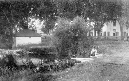
PRESENT BUILDINGS AND SPRING, LOWER P. F. RANCH |
No doubt you know that the ranch in question took its name from the Pratt and Ferris Cattle Company who were its one time, and, locally at least, its best known owners. I use the plural advisedly, for the company was not incorporated, as far as I can learn. Ferris had the controlling interest, which he sold to Levi Z. Letter, and the division of this property by an action in partition established our law on that subject in Wyoming. The case is known as Field versus Leiter, the "Field" being Marshall Field of Chicago, whom Colonel Pratt had constituted his trustee during his life time. It established some law but left a cloud on the title to the land involved, and the old ranch has never been cut up. While I said above that the ranch took its name from the name of the company I am rather inclined to think that it came directly from the brand which probably was used before the ranch was named. The brand is made thus: I traced the enclosed
map from a map made by the U. S. Reclamation Service, and it
is accurate. [See next page.] 6 Ibid., 1872, p. 267; ibid., 1873; p. 338. 7 Ibid., 1873, p. 243; ibid., 1874, p. 251. |
 |
|
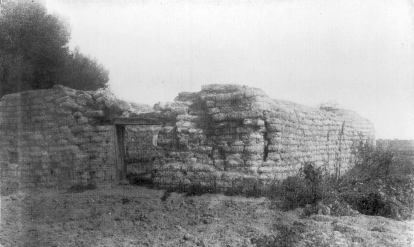
RUINS OF LOWER P. F. RANCH HOUSE |
In 1867, 1,200 Brulé and Oglala, under Spotted Tail and Swift Bear, were ranging on the Republican River, and at that time the Lower Brulés were "fully committed to the project of starting a reservation at the month of White River . . . " on November 6, 1868, the superintendent of the northern superintendency reported that "Spotted Tail, Swift Bear, and their followers, numbering in all about 1,200 Indians, have acted in the utmost good faith, and in compliance with the treaty have moved from their hunting grounds south of the Platte river to the new reservation in Dakota."8 The agency, called Whetstone, was established in August, 1868, on the west bank of the Missouri River near the mouth of Whetstone Creek, about eighteen miles by wagon road above Fort Randall and now in Gregory county, South Dakota. A year later the Indians immediately at the agency were about one thousand seceders from various bands of Sioux and Cheyenne, called Loafers. Spotted Tail was not yet settled down near the agency but had a roving camp from thirty to sixty miles distant. His people disliked the location and much preferred the forks of White River, about sixty miles, in a direct line, above its mouth, which is now on the northern boundary of Mellette county. There were some 0glala. with Spotted Tail.9 In 1870 about 4,500--Upper Brulés, Oglala and Loafers--were drawing subsistence at Whetstone agency, about half of them living at the agency.10 When the Red Cloud agency was removed from the Platte to White River, the Whetstone agency was situated about forty miles farther down the river, to the northeast. The mouth of Big White Clay Creek was about twenty miles still farther down.11 The agent, with the Indians and train of supplies, started on the journey June 1, 1871. The agent who conducted the removal said: "As the selection of a location was left to Spotted Tail and the other chiefs and headmen, I allowed them to guide me to the point chosen--Big White Clay--which was reached on June 24." The name Whetstone was carried over to the new location. The agency was originally "so-called from its former location at the junction of the Whetstone with the Missouri River."12 The location of the agency was very undesirable, and in Feb- 8 Ibid., 1867, pp. 268-9, 226; ibid., 1868--Report of the Secretary of the Interior, 1868, p. 690. 9 Ibid., 1869, pp. 757, 758. 10 Ibid., 1870, p. 670. 11 Report of the Board of Indian Commissioners, 1874, p. 65; Report of the Commissioner of Indian Affairs, 1874, p. 91. 12 Ibid., 1871, p. 527; ibid., 1872, p. 45. |
ruary, 1874, the "Sioux Commission" was appointed to select a new one. On September 5, 1874, it chose a site "at West Beaver Creek, ten miles south from the present agency," and twelve miles south of the boundary between Nebraska and Dakota. According to the report of the agent, dated September 20, 1875, the property was removed "last fall and winter". According to a census taken "after removal" the total number of Indians at the agency was 9,610--7,292 Agency Brulés, 700 Lower Brulés, 429 Northern Brulés, 1,189 Miniconjou and other northern tribes.13 The name was changed to Spotted Tail at the beginning of the year 1875. "Camp Sheridan was located at the same time, last year, as this agency, half a mile above us in Beaver Creek"; but it was removed to another place on the creek, a mile below the agency, in the summer of 1875.14 The post was situated in the northern part of township 33, range 46 west. Spotted Tail resisted removal, it was said, because his band was comfortably situated on Bordeaux Creek about twelve miles west of the Beaver. The commission reported that he was inordinately conceited and selfish.15 As early as 1874 the board of Indian commissioners insisted that the northern boundary line of Nebraska ought to be run. "A survey", they said, "will probably make it apparent that the Nebraska line runs far north of what the Indians suppose to be the southern boundary of their reservation. It is unfortunate that the treaty of 1868 determines the southern limits of the reservation by an imaginary line."16 In a joint memorial the Nebraska legislature of 1875 resolved That we call upon the general government and demand that it shall immediately remove from within the boundaries of the State of Nebraska, the Indian agencies of Red Cloud and Spotted Tail, and the Indians who have been brought into our state and located at and about said agencies without the consent of the state, and, also, that it take steps to abrogate the pretended hunting and other rights claimed to have been given said Indians in the said treaty"--of 1868.17 On October 27, 1877, about 4,600 Indians started from the Red Cloud agency, near Fort Robinson, to the mouth of Yellow Medicine Creek (now Medicine Creek, in Lyman county, South Dakota), the site of the new agency, at which the caravan arrived on November 25. The Indians established their camp about sixty miles southwest of the agency, not getting any nearer to the Missouri River. The Spotted Tail 13 Ibid., 1874, pp. 87, 95, 96; ibid., 1875 p. 254. 14 Ibid., 1875, p. 254. 15 Report of the Board of Indian Commissioners, 1874, p. 65. 16 Ibid., pp. 64-65. 17 Laws of Nebraska, 1875, p. 338. |
agency was removed in October, 1877, to the old Ponca agency. 18 An act of Congress of June 20, 1878, authorized the appointment of three commissioners "to visit the Red Cloud and Spotted Tail Indians" and "to confer with them about their permanent location . . . "19 The commission selected a site for the Spotted Tail agency on the western bank of Rosebud Creek, about two miles and a half from its confluence with the South Fork of White River, where the Indians wanted to go, though the commissioners wished to place it on Wounded Knee Creek. The Red Cloud agency was placed on Big White Clay Creek, in the southwestern part of the reservation and about a mile and three-quarters north of the Nebraska boundary. Spotted Tail moved in August, 1878, and Red Cloud in the following winter. The commission recommended that the names of the agencies be changed--Red Cloud to Pine Ridge and Spotted Tail to Rosebud--to avoid the confusion arising from the fact that the old names had been applied to many agencies.20 Whatever the reason for thus dropping the names of these famous chiefs, the incident must have added a pang to the painful surrender of their unrestrained freedom for the little limits of their final reservations. However, each died where, subject to the inexorable force of events against which they had fiercely fought, he had chosen to live. In 1916 there were 7,288 Indians, classed as Oglala Sioux, at the Red Cloud agency, and 5,521, classed as Brulé Sioux, at the Rosebud agency. The case of these two formidable bands of insurgent Indians is typical of the long struggle of the white masters of the red men to push them off their ancestral domains and confine them permanently to comparatively small reservations. The prosecution of this policy involved many bloody battles. The last of great consequence is called the Custer massacre, of 1876. The very last, in 1890, called the battle of Wounded Knee, was also a massacre, but this time of, instead of by, the Indians. It might, very charitably perhaps, be called a blunder. 18 Report of the Commissioner of Indian Affairs, 1877, p. 18; 1878, pp. XXIX, 36, 38, 157. 19 U. S. Statutes at Large, XX, 80, 232. 20 Report of the Commissioner of Indian Affairs, 1878, pp. xxviii, 38, 158, 159; ibid., 1879, p. 39; ibid., 1880, p. xxviii. For location of these Sioux agencies see maps ibid., 1878, p. 154; ibid., 1880, frontispiece. 9 |
 |
 |
 |
 |