Resource Center
On-Line Library
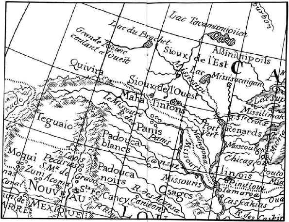
THE NEBRASKA REGION IN 1722
A small section of a map of 1722 by Delisle (spelled also De Lisle and De L'Isle), the leading geographer of France in the first quarter of the eighteenth century. It is one of a series of maps made by him from consultation with the French explorers in America or from their reports. Its "River of the Panis [Pawnees]" is undoubtedly meant to represent that which we today call the Platte, although here presented without its North and South Platte double head-streams. This portion of the Delisle map is reproduced from Justin Winsor's "Mississippi Basin," page 208.

