Resource Center
On-Line Library
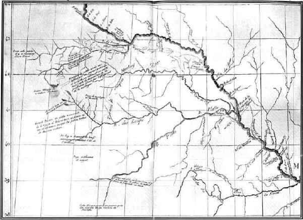
THE NEBRASKA REGION IN 1802
This map is by Perrin du Lac, a French geographer. It presents the knowledge of Nebraska gathered from reports of French fur traders who had explored the country during the century preceding its date. The principal rivers of Nebraska were then known, but their courses as shown by the map were very much misunderstood. A translation of the French legend upon the northern fork of the Loup river is interesting: "Great desert of moving sand, where there is neither wood nor land nor stone nor water nor any animals except small tortoises of different colors."____
Use center button below to view enlarged version of map.