The levee at Dayton, Ohio, which is strongly built of gravel, has an average height of about twenty feet through the main part of the town.
It is over twelve feet across the top and about thirty-five feet broad at the base. It is wide enough to allow carriages to go along its top. The levee ceases along some parts of the course of the Miami River.
This river, which cuts the town in two, is approximately 250 feet broad at most of the points within Dayton. Wolf Creek, a tributary on the west, has heretofore caused most of the trouble from floods.
North Dayton has usually been the section most damaged in previous inundations. It lies at a wide bend in the river. Central Dayton is down on a flat. The highest region is occupied by East Dayton. The population is well distributed in detached houses, with no congestion.
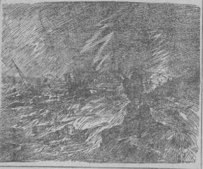
Dayton is situated in the valley on the east bank of the Miami River at its junction with Mad River. To the north is a low region through which vast quantities of water might pour down and wreak terrible destruction.
The population of the city is almost 125,000 and it is one of the most prosperous and rapidly growing municipalities in the State. It is adorned with many handsome public buildings, such as the Dayton State Hospital, the court house and a magnificent City Hall. In the suburbs, two miles west of the city, is the National Military Home for Disabled Volunteers of the Civil War, with 640 acres of beautiful ground and large buildings accommodating 6,000 persons.
One of the principal avenues of the city is the Boulevard, which is built on land made from the Miami River bed. Along this are located many of the largest residences, which would have been destroyed by an unusual disturbance of the waters.
The manufacturing industry, which is important, is facilitated by numerous canals, supplied by reservoirs located outside the city.
Dayton was founded in 1805 and was named in honor of Gen. Jonathan Dayton. It was chartered as a city in 1841 and its growth has been remarkable since that time.
 |
| -Philadelphia Press. |
During the forty-eight hours ending at 1 oÆclock Tuesday morning, March 25, 1913, no less than five and one-half inches of rain, the heaviest on record, fell at Cleveland, Ohio.
Reports show that this condition prevailed not only at Cleveland, but over a large part of Ohio and Indiana. Hard showers were also reported in Eastern Ohio Tuesday night, and all the rivers and streams in the two states being already swollen, conditions were ripe for the breaking of levees and dams that night.
Four rivers, draining the district of which Dayton, Ohio, is a center, contributed their waters to the torrents that rushed over the doomed cities Tuesday night. These were the Miami, Scioto, Wabash and White Rivers, which drain the districts hereinafter described.
There were two reservoirs on the Miami River above Dayton. One was known as the Powerhouse reservoir and the other as the Lewiston. The Miami River was flooded to the edge of its banks and levees on Tuesday morningŚand levees formed a loop around a considerable section of Dayton. Then the waters of the Powerhouse reservoir burst forth on top of the flooded MiamiŚand a great wave came suddenly tearing along, picking up frame houses like chips in its path, and crushing brick factories and large buildings as it swept in a resistless torrent.
"Daytonians had never dreamed of such a flood menace," said one who resided in the Riverdale section of Dayton for 40 years, on receipt of the surprising news. "The levees were considered by them to be among the strongest and finest in the country, not even those of the Mississippi excepted. It is incredible to me that these substantially built levees should give way.
"It is my impression that the trouble began with an overflow at the intersection of Mad River with the Miami, northeast of the city.
"The levee at that point is but a small one compared with the others, being only eight to 10 feet high, while those adjacent to the Main Street bridge were from 20 to 30 feet in height.
"In the early seventies the water came over the levee at that point and flooded East Monument, St. Clair and East First Streets.
"The surplus water that came from the damming up the Main Street bridge and the overflow from the intersection of the Stillwater and Mad Rivers with the Miami is the only theory that one familiar with the territory can accept."
This old citizen of Dayton had seen the Riverdale section flooded a number of times from the overflow, but recalls no previous loss of life or serious damage to property during his 40 yearsÆ residence there.
Continue
Back
Back to Legacy
© 2001, Lynn Waterman