Clark County, Wisconsin
~~Maps & Gazetteers~~
Surveying
Surveying Clark County (1842-1901)
Wisconsin State Maps
County Maps
1853 Map of Pine Valley County, Wis., (currently Clark County)
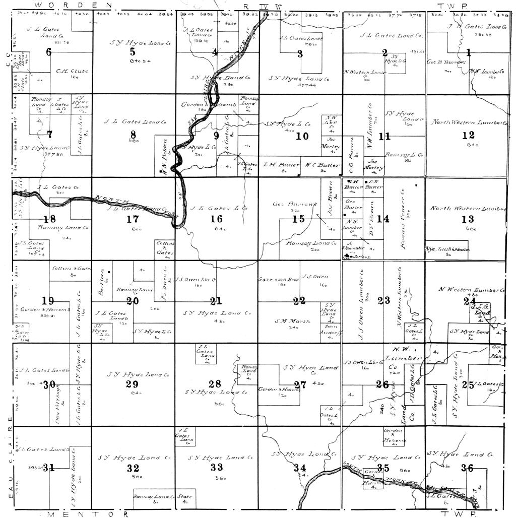
1854 Clark Co., WI Township Map
![]() 1857
Central WI (when Clark County was much bigger!);
Enlarged Copy; contributed by
Pat Phillips.
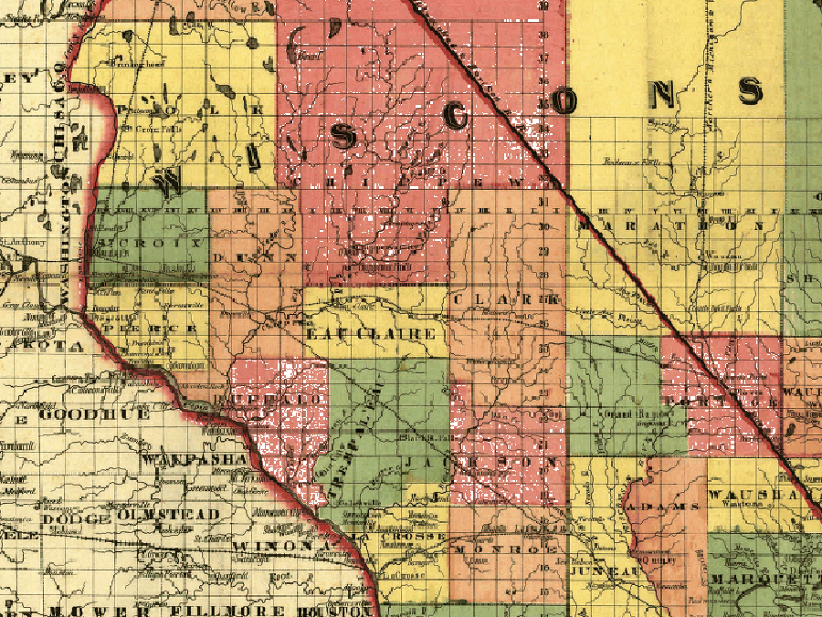
1857
Central WI (when Clark County was much bigger!);
Enlarged Copy; contributed by
Pat Phillips.
The Clark County Map Changes (1856 - 1874)
![]() 1871
Minnesota/Wisconsin RR; Enlarged Copy;
Pat Phillips.
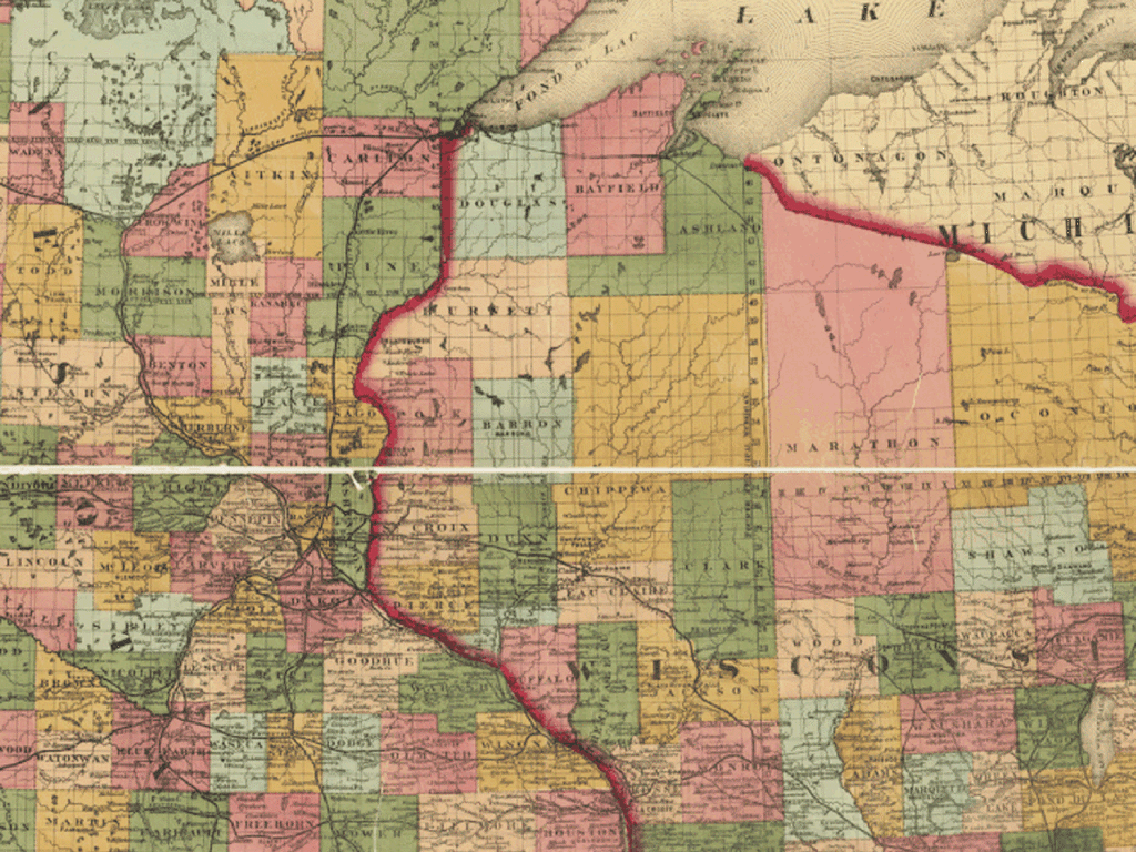
1871
Minnesota/Wisconsin RR; Enlarged Copy;
Pat Phillips.
![]() 1895
Rail Road Map; Enlarged Copy; contributed
by Pat Phillips.
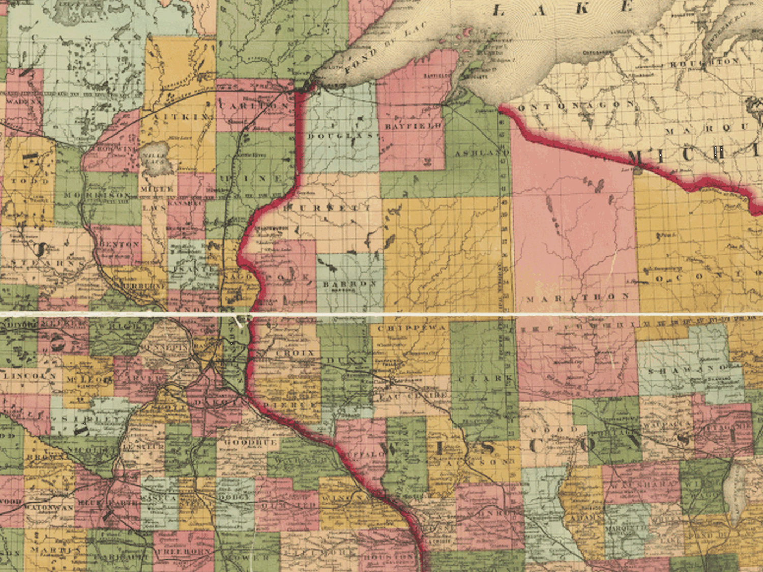
1895
Rail Road Map; Enlarged Copy; contributed
by Pat Phillips.
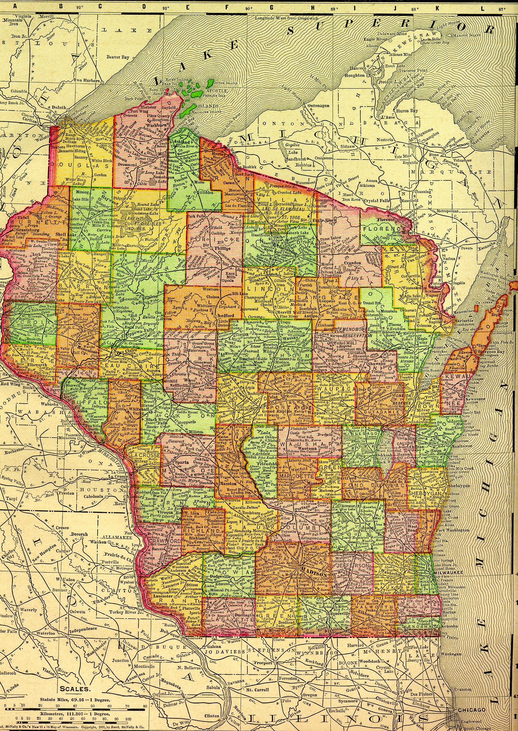
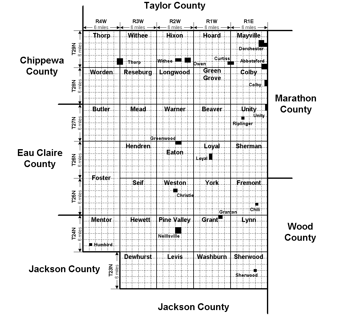
County Map (shows all the townships)
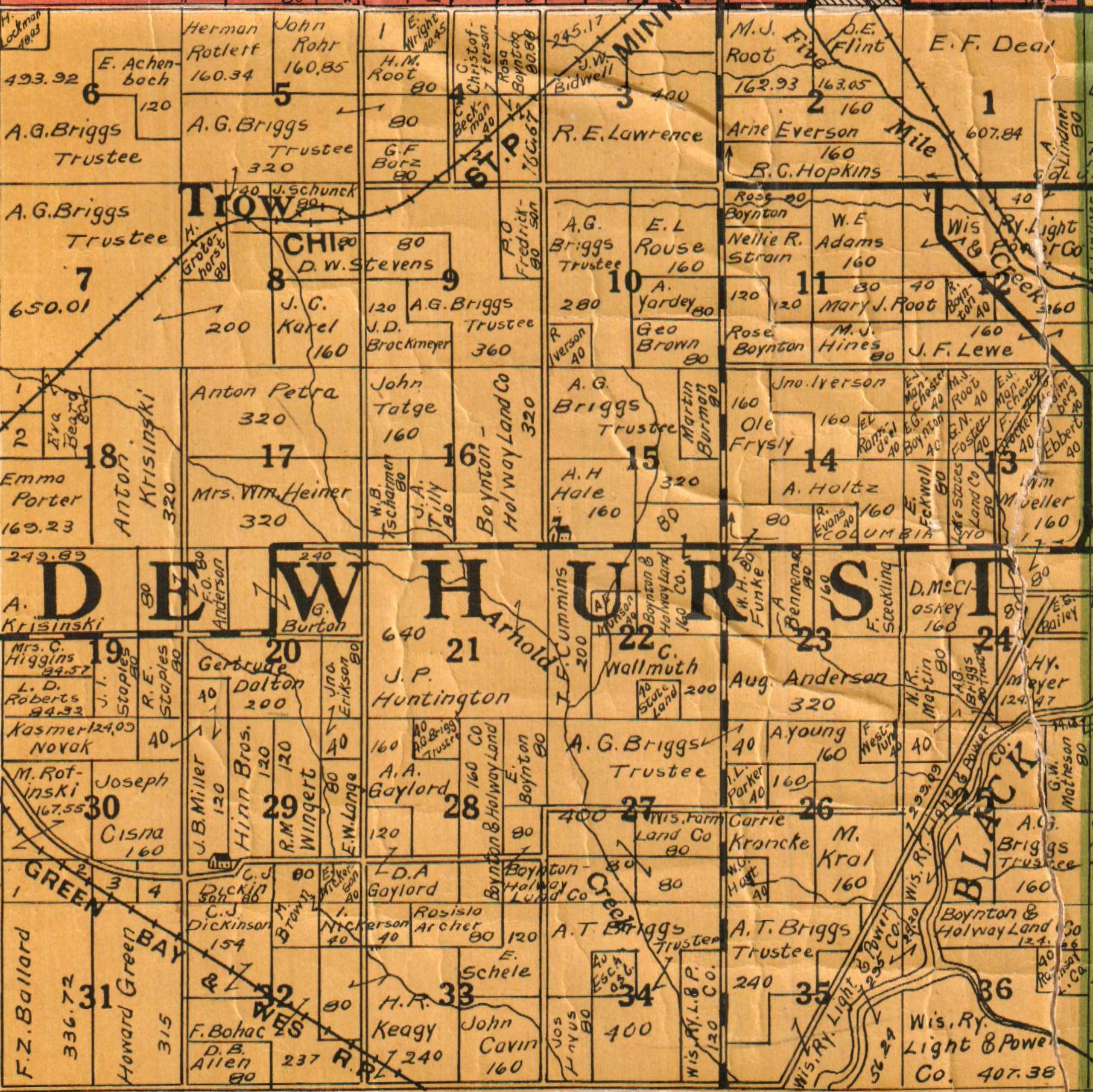
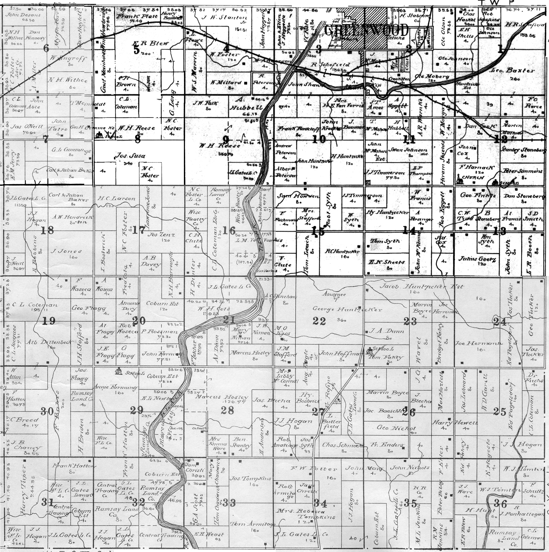
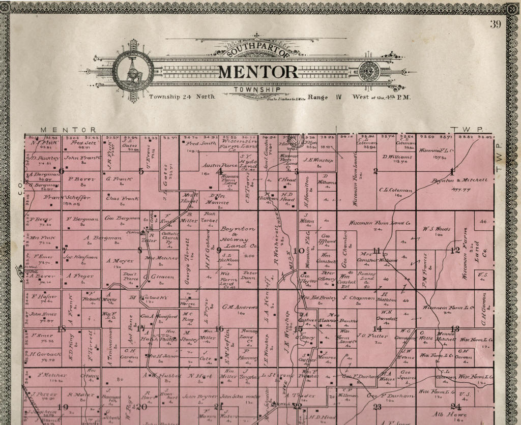
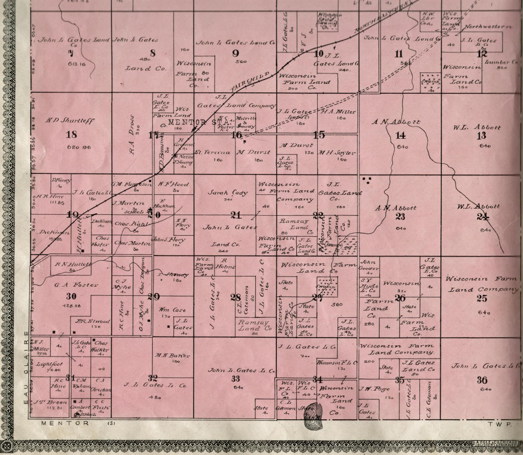
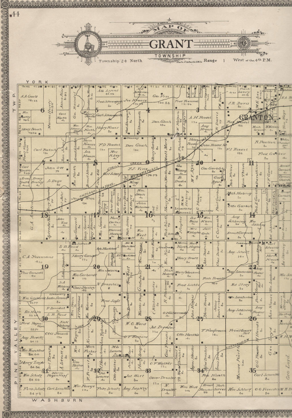
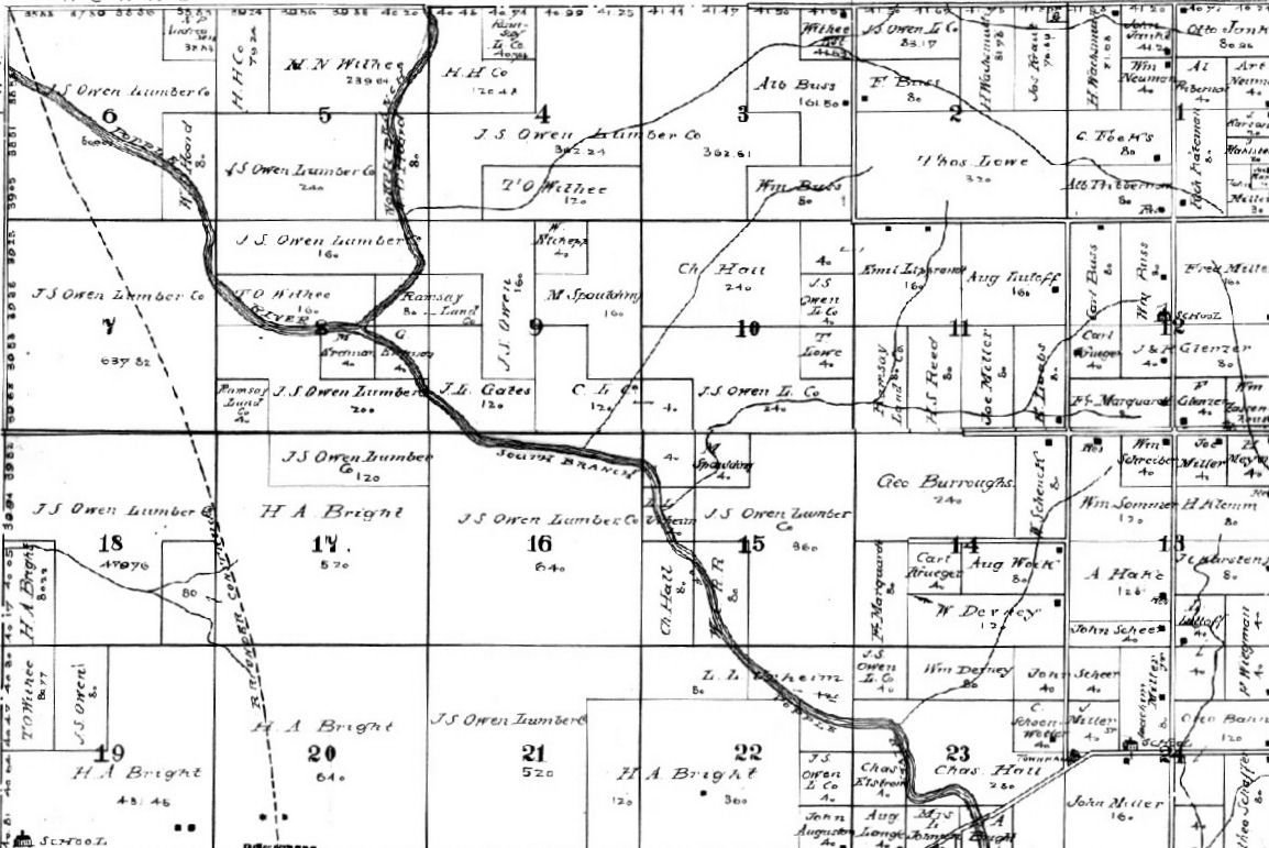
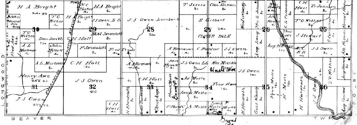
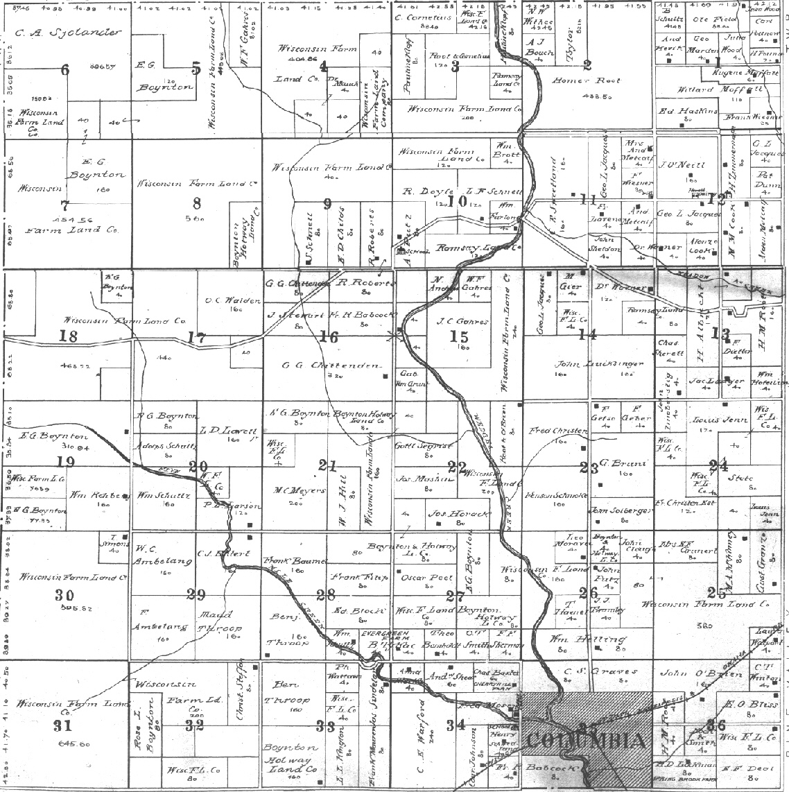
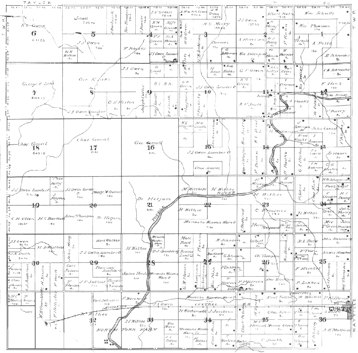
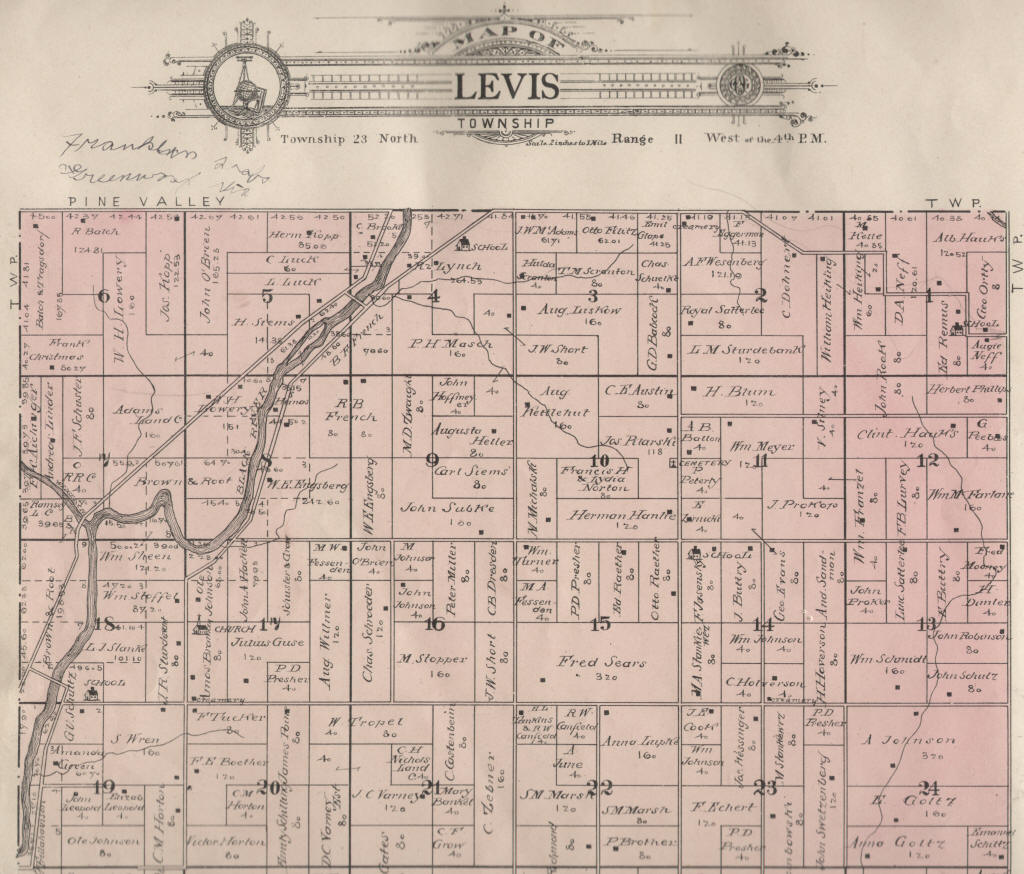
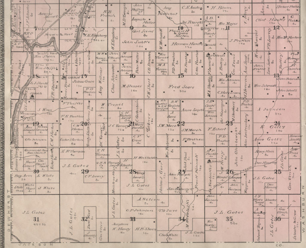
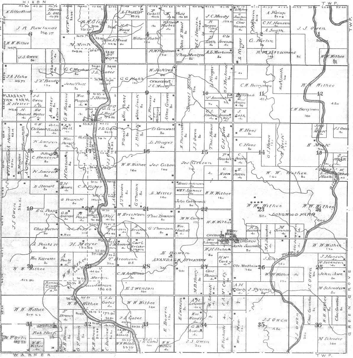
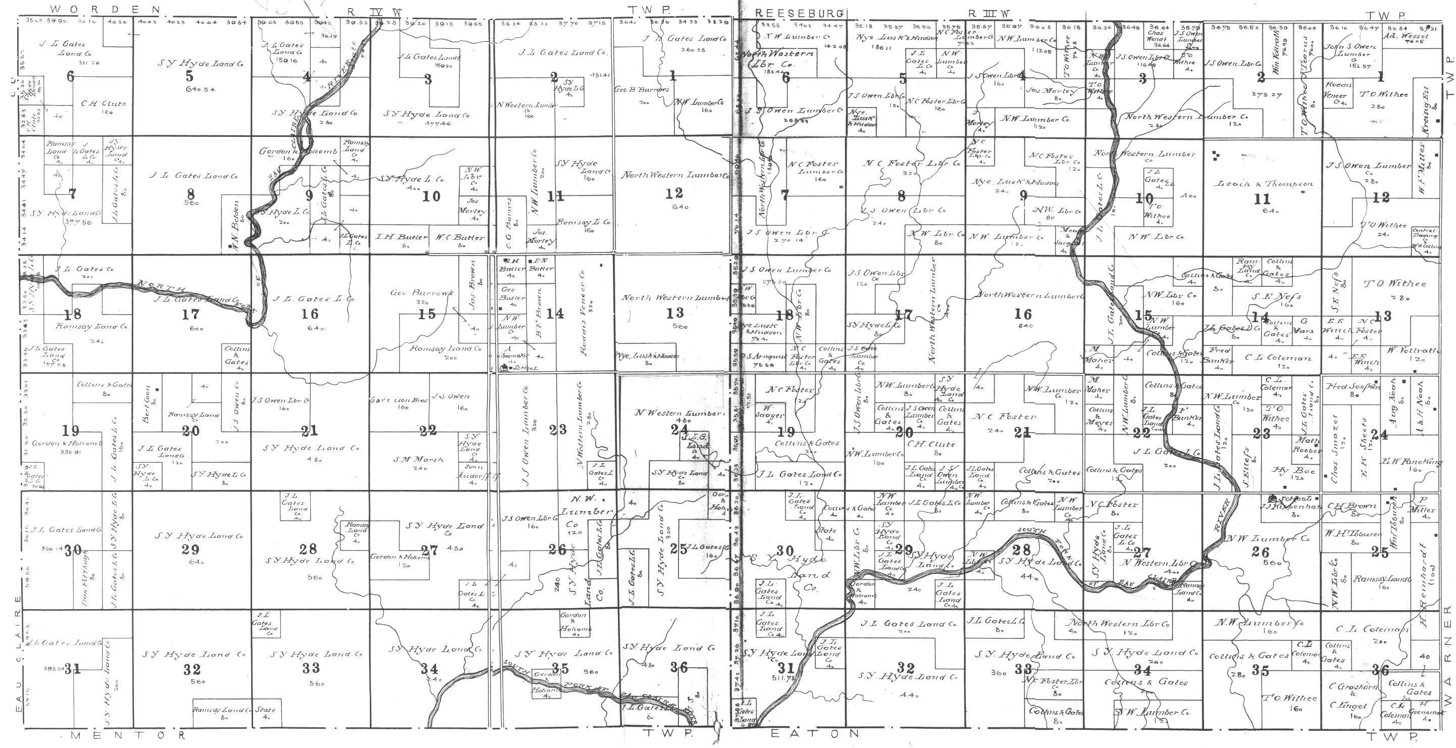
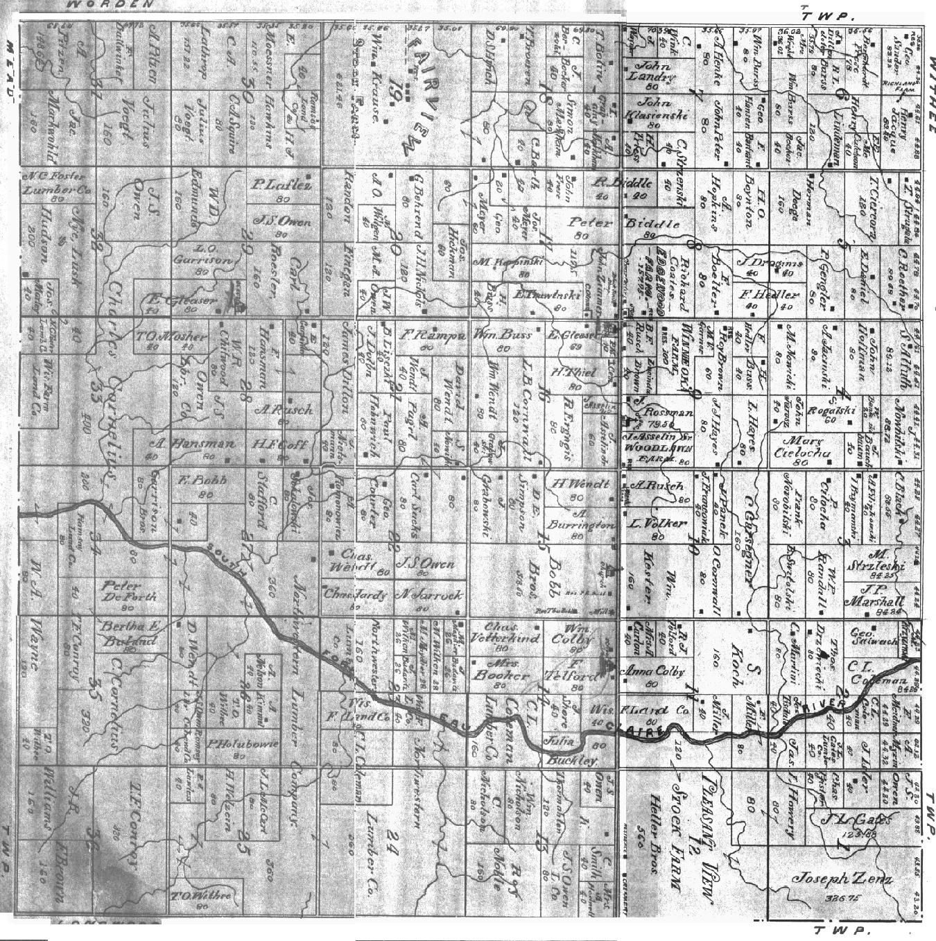
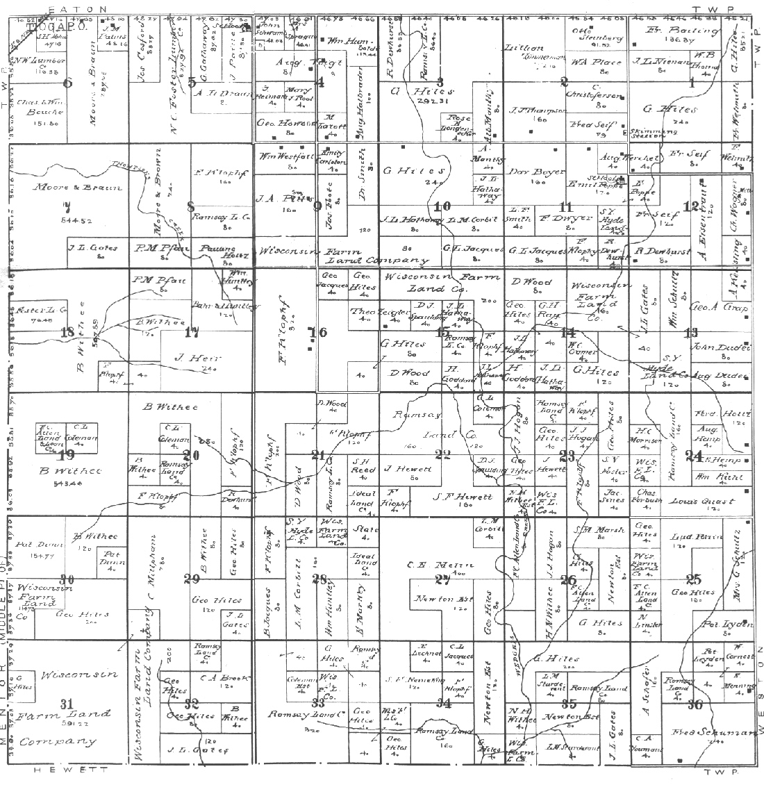
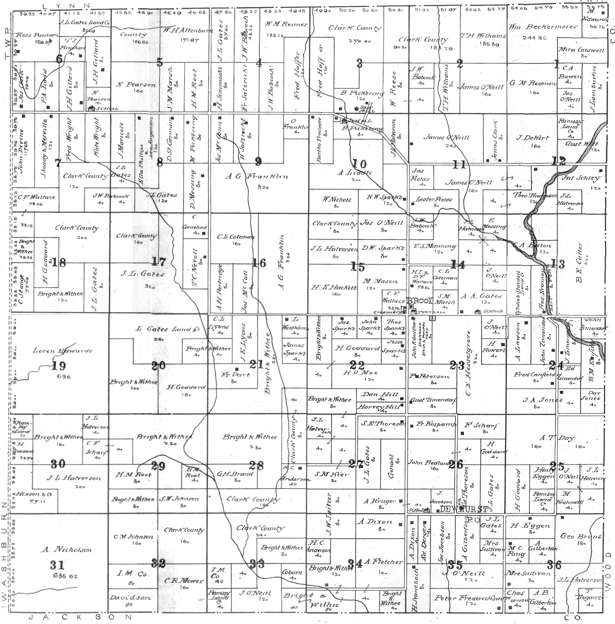
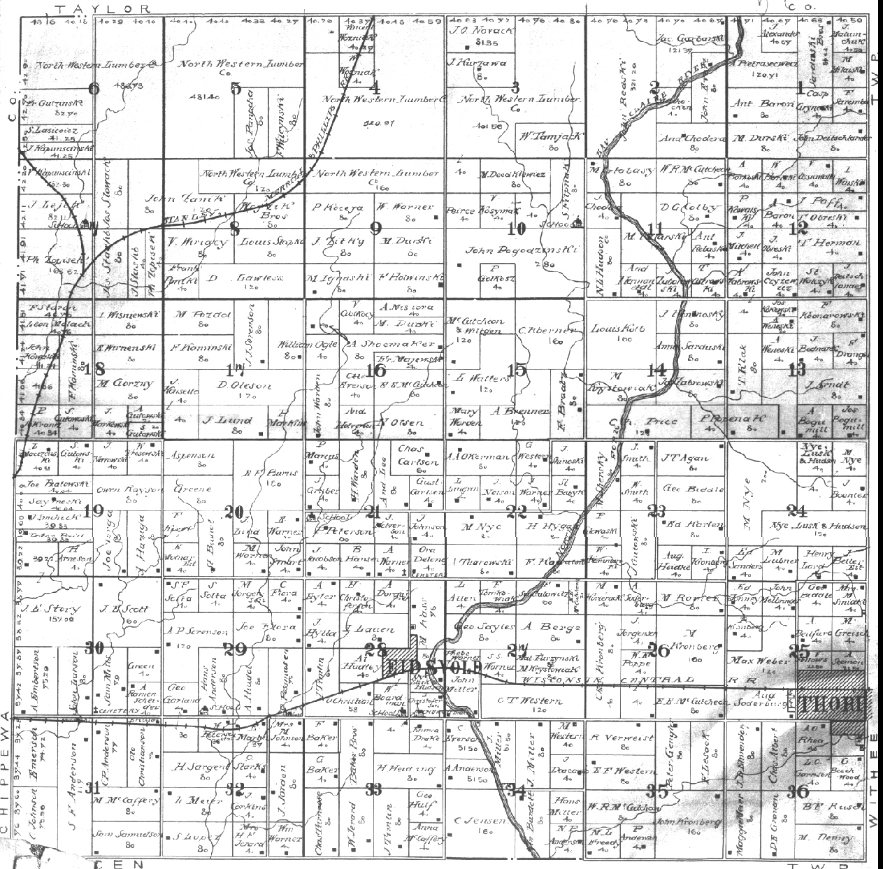
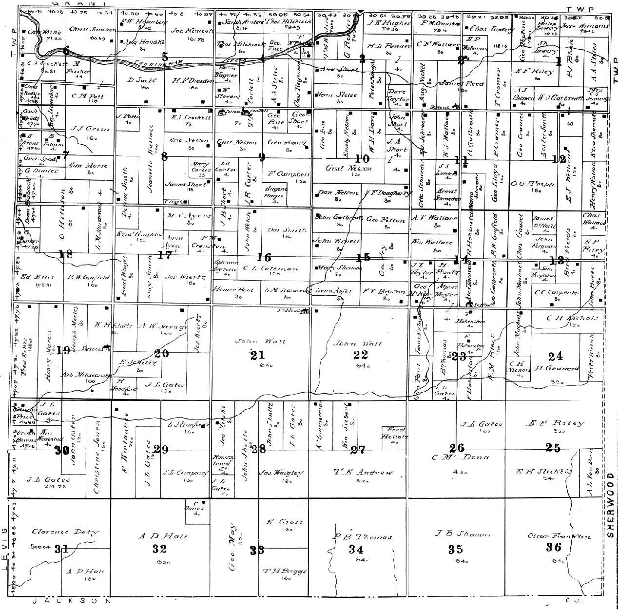
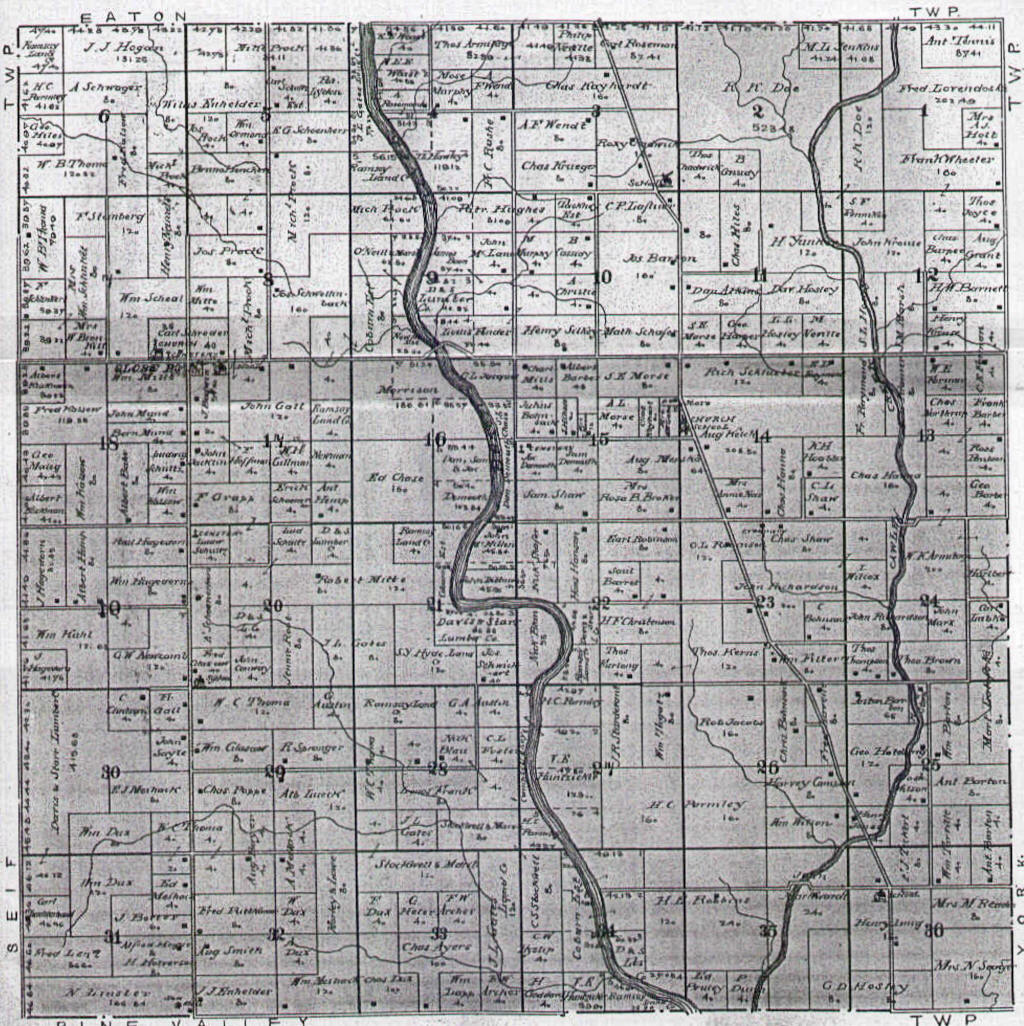
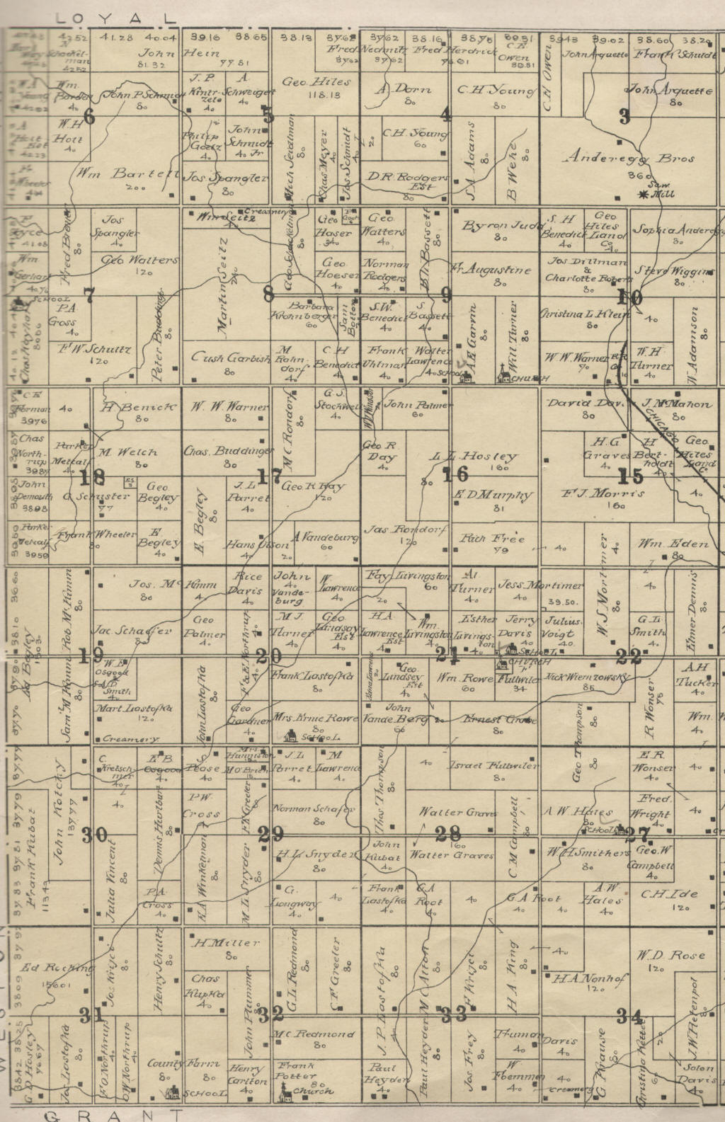
1906 Atlas & Plat Book--Cover, Beaver, Butler, Colby, Dewhurst, Eaton, Foster North, Foster South, Fremont, Grant [E] [W], Green Grove [North] [South], Hendren, Hewett, Hixon, Hoard, Levis [North] [South], Longwood, Loyal, Lynn, Mayville, Mead, Mentor, Pine Valley, Reseburg, Seif, Sherman, Sherwood, Thorp, Unity, Warner, Washburn, Weston, Withee, Worden, York [East] [West].
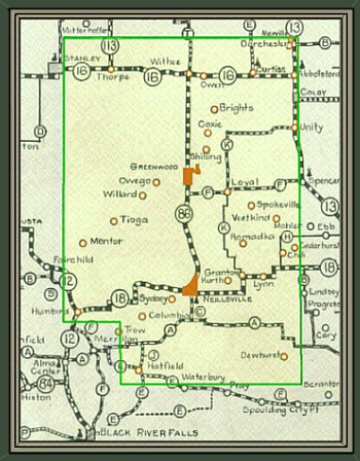
1915 North-Central Wisconsin Soil Map
|
© Every submission is protected by the Digital Millennium Copyright Act of 1998.
Show your appreciation of this freely provided information by not copying it to any other site without our permission.
Become a Clark County History Buff
|
|
A site created and
maintained by the Clark County History Buffs
Webmasters: Leon Konieczny, Tanya Paschke, Janet & Stan Schwarze, James W. Sternitzky,
|