HPR Banner
NEBRASKA HISTORY
AND RECORD OF PIONEER DAYS

Published Monthly by the Nebraska State Historical Society
Editor, ADDISON E. SHELDON
Associate Editors
The Staffs of the Nebraska State Historical Society and
Legislative Reference Bureau
Subscription $2.00 Per Year
q All sustaining members of the Nebraska State Historical
    Society receive Nebraska History without further payment.
q
Entered as second class mail matter, under act of July 16,
1894, at Lincoln, Nebraska, April 2, 1918.

VOLUME II.

JULY-SEPTEMBER, 1919

NUMBER 3


THE COUNCIL BLUFF HISTORICAL PARK
   Two centennial celebrations have now been held at Fort Calhoun. The first commemorated the Lewis and Clark Council with Nebraska Indians, August 3, 1804. The second recalls the establishment of Fort Atkinson in 1819-20 and with it the coming of school, library, farming, factory and other companions of civilized white settlement to the Nebraska region.
   As the decades and centuries come and go, the beginnings grow in importance, honor and public consideration. The places of historic interest will grow into objects of perpetual pilgrimage and patriotic inspiration. In Nebraska a few such places will become famous.
   One of these is the Council Bluff plateau at Fort Calhoun. A hundred years hence it will be another Plymouth Rock in interest and attraction, visited by tourists from all parts of the world for its commanding beauty and for its pioneer associations with the Great West.
   It is time now at the end of a hundred years to dedicate to the public use the places made memorable in our history and preserve there in permanent form all that recalls the deeds of the past. We have already delayed this too long.
   Fort Atkinson stood on a noble bluff overlooking the Missouri valley for many miles. It is also the site of the Lewis and Clark Council. An historical park should be made here. A building to preserve the many relics of the ___rs should be in the park. An automobile drive should circle the park, giving a view of the Missouri valley. The expense of such a park should be met jointly. by the citizens of Fort Calhoun and the state. Plans to achieve this result will be worked out during the coming months.


OUR NEWSPAPER DEPARTMENT
   The newspaper department of the Society is now receiving four hundred and nine of the state publications. These include all but sixty-eight of the papers or periodicals of any description which are published regularly in Nebraska.
   The papers now coming cover all of the state from Harrison to Falls City, and from South Sioux City to Haigler. Besides the regular newspapers, all classes of people and societies are represented, such as the Lincoln Trade Review, the Omaha Trade Exhibit. the Western Banker, the Philatelic West, of Superior, devoting its pages to the interest of the coin collector. There are several farm magazines, and there are children's publications, such as Every Child's Magazine, and Homeless Children's Advocate; and we have teachers magazines, religious and political publications - Indian, Danish, German, Jewish and Catholic; and the Christian Record, of College View. published in the point system for the blind.

   The busy newsgatherers are compiling daily the history of every nook and corner of the state, with its tragedies and joys, its developments both mental and physical, weaving wonderful life stories in these pages.
   It is the mission of the Society to collect and preserve these valuable records. Many publishers keep files only for a short time Unless the county keeps them, the records published therein are frequently lost. This Society is the only organization in the state which endeavors to preserve these papers, and we have calls from all over the state for help in finding proof of publications. One incident will illustrate this: a town in Nebraska was in a fight about a waterworks system, the clerk's books during the year the ordinance was passed, were lost, and the newspaper publishing the legal notices had no files of the paper. What appeared to become it long-drawn out wrangle was concluded quickly by finding the desired papers stored safely in our vaults.


PERSHING'S WREATH TO LAFAYETTE
   The tomb of Lafayette at Paris is most difficult to find. It is in the back garden of a convent in the Rue Picpus. Readers of Victor Hugo's Les Miserables need no introduction to the Rue Picpus, for it is the scene of Jean Valjean's most thrilling adventures. Last December, after an hour's search of that quarter of Paris, I found myself standing in front of a high wall with an iron-barred gate. Thru a peephole an eye appeared when I touched a button. After explanations of my mission I was admitted, but my camera was at once put in cold storage. Led by the attendant I followed a winding path through shrubbery, around corners. under heavy doorways, until in a remote corner he suddenly pointed out the tomb, smothered with flowers and with a large United States flag above it. With what emotion an American stands for the first time, uncovered at the grave of Lafayette! Dear to the imagination of every patriotic American schoolboy every detail of his life. What a scene! All about are the blazoned monuments of French nobility, most of whom died in the French revolution. The tomb of Lafayette, modest and low, is in the farthest corner of the ___________ the wall. Laying my own tribute on the tomb I noticed the large metallic wreath of immortelles left by General John J. Pershing a few weeks before. I told the attendant that I was from the home of General Pershing. He quickly bent over, picked a leaf which had been broken from the Pershing wreath and fallen on the tomb, gave it to me in silence. And that is how a leaf from the Pershing wreath on the tomb of Lafayette is one of the treasures in the museum of the Nebraska State Historical Society.


GEORGE A. HUNT, PIONEER AND LEGISLATOR
   George Artist Hunt died at his home in Crete on July 6, 1919. Mr. Hunt was born in Chili, Ohio, November 28, 1846, while his father, Jacob S. Hunt, was in service in the Mexican war. He was also captain of Company G, Fifth Regiment Iowa Volunteer Infantry in the Civil War. The Hunt family came to Nebraska in December, 1862, and settled in Saline county on the Blue River below Wilber. Captain Hunt was the first probate judge of Saline county, elected in 1867, and a member of the House of Representatives of the third legislature - which met in regular session in 1869 - from the tenth district comprising the counties of Saline, Lincoln and Kearney.
   George A. Hunt was employed at the Comstock or Oak Grove ranch, on the Little Blue River, when it was attacked by Indians on August 7, 1864. He was wounded in the thigh by a rifle ball. On October 18, 1862, he enlisted at Bellevue, as a private, in Company D, Second Regiment, Nebraska Cavalry Volunteers, and was discharged on September 18, 1863.
   Mr. Hunt freighted across the plains with an ox team and carried mail on horseback between Camden and Swan City, Nebraska, in the early '60s. He married Mary A. Bickle of Crete, April 5, 1868; in 1875 moved to Wilber, engaging in a general merchandise business continuously for nineteen years. In 1899 he moved to Crete, where he lived until his death. Mrs. Hunt died in 1901, and in 1907 Mr. Hunt was married to Mrs. Mary Sampson. He was a commissioner of Saline county from 1862-1883 and from 1909 to 1915, and a member of the House of Representatives of the 27th and 28th legislatures - of 1917 and 1919.


2

Nebraska History and Record of Pioneer Days


THE FORT ATKINSON CENTENNIAL


Six Thousand People Celebrate the Founding of the First Fort and White Settlement in Nebraska, October 11.


Colonel B. W. Atkinson, Grandson of the Founder, and Colonel G. L. Townsend, of the Sixth Infantry - - Omaha Indians, U. S. Soldiers from Fort Omaha, Pioneers of Washington and Douglas Counties; Patriotic Societies, Join in Observation of the Day.

Picture or sketch

(handwritten below picture - "See D 173")

Col. B. W. Atkinson in foreground Background panoramic painting used in pageant of founding of Fort Atkinson at centennial celebration.

   Saturday, October 11, about six thousand people assembled on the historic plateau, sixteen miles north of Omaha where now stands the village of Fort Calhoun. In the assembly were: U. S. 20th Infantry band, Fort Crook; Blair Military Band; Balloon Corps, U. S. army, Fort Omaha; Omaha Chapter Daughters of American Revolution; Isaac Sadler Chapter Daughters of 1812; Soldiers of Civil War, Spanish War and World War; Uniform Rank Modern Woodmen of America; Washington county pioneers; Douglas county pioneers; delegation of Omaha Indians (some of them in automobiles); board of governors Omaha Ak-Sar- Ben; school children; citizens of Washington, Douglas and other counties of Nebraska and Iowa.
   Col. F. A. Grant, U. S. army, was marshal of the day. In the parade which marched about the town were floats representing the old-time ox team, the prairie schooner, the Indian pony and travois, the soldiers and Missouri river trappers of 1819, the pioneers of Washington county, and the soldiers of the World War.
   The park at Fort Calhoun is at the foot of the hill where stood the signal station of Fort Atkinson a century ago. Here the exercises of the day were held, with the following program:
   Music by Band.
   President Everett Buckingham waived the honor of introducing the speakers in favor of Secretary Sheldon of the State Historical Society.
   "The Historical Significance of the Celebration," Albert Watkins.
   "The Sixth Infantry Regiment, U. S. Army," Col. G. L. Townsend.
   "The Founders of Fort Atkinson," Col. B. W. Atkinson.
   "The Grand Army of the Republic and Our Western Frontier," Captain C. E. Adams.
   "The Pioneers of Nebraska," Mrs. Philip Potter.
   "The Sons of the American Revolution," Dr. B. F. Bailey.
   Basket picnic dinner.

   At three o'clock the pageant, "Landing of the United States Army and Greeting by Omaha Indians," under direction of Curator E. E. Blackman of the State Historical Society. This was given in the open air with a large background, twelve feet high by sixty feet in length, painted by Charles Plein, showing the keel boats, the steamboat Western Engineer and the river front along the Council Bluffs a century ago.
   At five o'clock the U. S. balloon corps staged the balloon ascension from the hillside near the park. A gentle breeze from the southwest carried the balloon over the plateau where stood old Fort Atkinson, above the military burying ground, above the site of the first cantonment built by the soldiers in 1819 on the Missouri River bottom and the rich fields where so much successful Nebraska farming was done in those early years. An aeroplane whirled in the sky at the same time. What contrasts between the early frontier post on the border of the western wilderness and the rich farms and flourishing cities of today!

The Lewis and Clark Marker.
   On August 3, 1904, the first centennial celebration was held on the Council Bluffs plateau at Fort Calhoun. A glacial stone was placed on the high school grounds by the Nebraska D. A. R., S. A. R., and State Historical Society. The site was not well chosen and part of the program of the Fort Atkinson centennial was the removal of the boulder to a better site in the park.

Reunion of Pioneers.
   The pioneers of Washington and Douglas counties held their annual reunion. Dancing on the platform in the grove was a magnet for the young people during the afternoon and evening.

The Fort Calhoun Committee.
   The Fort Calhoun members of the celebration committee deserve warm recognition for the splendid teamwork done to make


Nebraska History and Record of Pioneer Days

3


their part of the centennial celebration a success. They include, on the general committee, J. D. Vaughan, H. J. Livingston, F. J. Wolf, Rev. A. E. Hutchinson, Fred H. Frahm.

   On the local committees:
   Local Committee - Rev. A. S. Hutcheson, Frank Adams, H. J. Livingston, Henry Rohwer, Fred H. Frahm.
   Concessions - H. J. Livingston, Otto Kruse, Win. Sievers, Dr. E. S. B. Geesaman, V. A. Boggs.
   Entertainment - Claus H. Jipp, Merlin Wagers, Roy Slader.
   Parade - Frank Wolff, J. Howard Beales, H. L. Morse, G. V. Beadle, Mrs. D. W. Marr, Mrs. J. W. Trisler.
   Finance - Henry Rohwer, Wm. Sievers, Otto Kruse, Ernest Rix, W. P. Cook, A. W. Krambeck, Walter Goll
   Grounds - Rev. A. S. Hutcheson, J. D. Vaughan, Ira Dixon, H. J. Livingston, Richard Sievers, Chas. Snuffin, Claus Mehrens, Ira Wagers.
   Program - Mrs. Elsie Rix Cook, Miss Mary Enyart, Mrs. A. S. Hutcheson.

   Publicity - Frank Adams, Fred H. Frahm. D. C. Van Deusen.
   Transportation - D. W. Marr, Merlin Wagers.
   The total amount of money raised in Washington county was $1,500; besides this $200 was donated by Everett Buckingham, $100 by Randall Brown and $10 by Dr. Harold Gifford, all of Omaha. In time and service much more was given by the military commanders at Forts Crook and Omaha and the men and women of all classes who cannot be named here.


COUNTY MEMORIAL BUILDINGS
   Saunders county has organized a memorial and historical association one of whose purposes is the erection of a suitable memorial for the soldiers and sailors of that county in the World War. Delegates from every part of the county were present at the organization meeting. It is proposed to make this a permanent historical building with the names of all Saunders county soldiers upon its walls. The State Historical Society will be glad to see such a memorial building in every county of the state.


Picture or sketch

(handwritten below picture - "See D 173")

Landing at Fort Atkinson Pageant. Foreground, a group of Omaha Indians and Soldiers in Uniform of old Regular Army. Background, pageant picture.


Picture or sketch

(handwritten below - "See C 1298")


4

Nebraska History and Record of Pioneer Days


WHY FORT ATKINSON WAS ESTABLISHED
By Albert Watkins

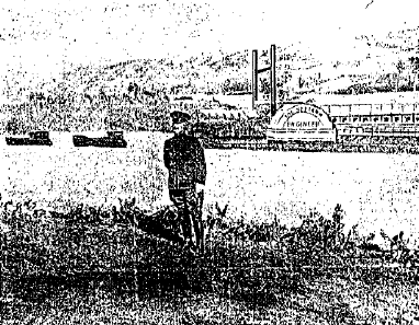
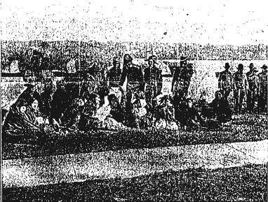
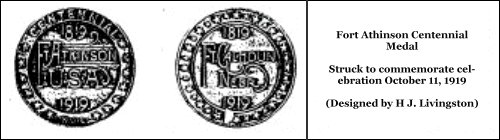
   In my address at the centennial celebration of the event, on October 11, I undertook to answer that question comprehensively - to show that the post was established on account of international complications which had an intimate relation to the titanic struggle of England with France and Spain during more than two hundred years the American phase of which began to culminate in the conquest by England of the vast French domain called Canada in 1762; that the other English colonies conquered independence and then got rid of France and Spain by acquiring from France what is called the Louisiana Purchase, in 1803, and Florida from Spain in 1819-21. Rightfully, Louisiana belonged to Spain, for the Great Napoleon had acquired it only in trust in 1800.
   Thus the United States finished what England had left undone - did just as England would have done if she had not lost her colonies by the revolution. About the time that Spain lost Florida, Mexico, by achieving independence, gained all the rest of her territory in North America.
   Even after the war of 1812, between England and the United States, British fur traders continued to trespass upon our territory, and her powerful organizations, the Mackinaw Company, the Northwest Company of Montreal, and the Hudson Bay Company, controlled the business along our entire northern border (which then extended not farther west than the Rocky Mountains), and they skillfully induced the Indians to aid them in the aggression. Immediately after the peace of 1815, Monroe, then secretary of war, recommended that a military post be established at the mouth of the Yellowstone River. In 1816 Monroe was elected president, and in 1817 John C. Calhoun, his secretary of war, undertook the great enterprise of establishing a chain of posts along the entire northern border, to guard against the hostility of the Indians who, he declared, were "open to the influence of a foreign power." An act of Congress passed April 29, 1816, prohibited persons not citizens from going into territory held by Indians within the United States without passports, and the issue of licenses to such persons to trade with Indians within the United States. The posts were needed to enforce this act.
   In his annual message to Congress on November 16, 1818, President Monroe explained the status as follows:
   With a view to the security of our inland frontiers, it has been thought expedient to establish strong posts at the mouth of the Yellow Stone River and at the Mandan village on the Missouri and at the mouth of St. Peters on the Mississippi, at no great distance from our northern boundaries. It can hardly be presumed while such posts are maintained in the rear of the Indian tribes that they will venture to attack our peaceable inhabitants. A strong hope is entertained that this measure will likewise be productive of much good to the tribes themselves, especially in promoting the great object of their civilization.
   Instead, there was intermittent warfare between whites and Indians "in all the wide border" in question up to the beginning of the sixties, and from that time almost continuous war, with many massacres, until by about 1879 all the tribes had been forced onto circumscribed reservations, where their remnants still remain.
   In his annual message of December 7, 1819, the president reported that
   The troops intended to occupy a station at the mouth of the St. Peters, on the Mississippi, have established themselves there and those who were ordered to the mouth of the Yellow Stone, on the Missouri, have ascended that river to the Council Bluff, where they will remain until the next spring, when they will proceed to the place of their destination.
   Distance continued to enchant the president's expectations touching the Indians. "I have the satisfaction to state," he continues, "that this measure has been executed in amity with the Indian tribes, and that it promises to produce, in regard to them, all the advantages which were contemplated by it." In less than four years - the spring of 1823 - there was a bloody clash between American traders and the chronically hostile Blackfeet, and also with the Arikari.
   There had always been jealous opposition in the East to expansion in the West - against the acquisition of Louisiana, for example; but in this case it was most strenuous in the Southwest. The scandals attending the Yellowstone Expedition, which was sent up the Missouri in 1819 to establish the proposed posts, so strengthened this opposition that it was able to force the abandonment of the principal part of the enterprise and confine it to maintenance of but one post, at Council Bluff, far below the two sites at first projected. On December 29, less than a month after the president's announcement that the original plan would be carried out the secretary of war, in answer to an inquisitorial letter from the chairman of the House committee on military affairs, said that "to

guard against the hostility of Indians, who were "open to the influence of a foreign power," measures had been taken "to establish strong posts at the Council Bluffs and the Mandan village on the Missouri . . . " In the meantime the secretary, and presumably the president also, had discovered that
   The position at the Council Bluff is a very important one, and the post will consequently be rendered strong. . . . It is at the point on the Missouri which approaches the nearest to the post at the mouth of the St. Peters, with which, in the event of hostilities, it may cooperate.
   Being but "180 miles in advance of settlements on the Missouri and in the center of the most numerous and powerful Indian population west of the Mississippi," the secretary believed it "to be the best position on the Missouri," and aside from other objects, "ought to be established for that purpose alone." But other considerations soon developed which superseded these superior advantages. On the 7th of March, 1827, an order was issued by the war department for establishing a post near the mouth of the Little Platte River, and on the eighth of May, Colonel Henry Leavenworth reported the selection of the site for the famous fort which has always borne his name. On the 6th of June a flotilla of three keel boats and four barges started with the garrison and equipment of Fort Atkinson on the way to Cantonment Leavenworth.
   The principal reasons for thus changing the location of the post were, that it should be nearer the Indians, who in great numbers were soon to be removed from their homes east of the Mississippi River to territory now included in Kansas and Nebraska, and to the Santa Fe Trail, whose traffic had lately become important. The report of Colonel Croghan, inspector general of the army, after an examination of Fort Atkinson in 1826, that the Indians were at peace and "nothing is likely to disturb the present quiet," and the almost fantastic theory of General Jacob Brown, commander-in-chief of the army, formulated in a letter to the secretary of war, dated January 11, 1826, that large bodies of savages could not find a secure retreat in the open country between the Missouri River and the Rocky Mountains; that "Without the refuge and protection of forests they would not venture in the prosecution of hostilities against us"; and even if they should, "it would not require a large command of well trained mounted infantry, with a few pieces of light or flying artillery, to disperse any force of savages which might be collected to oppose them and, if it should be necessary, sweep them to the Rocky Mountains."
   Such fatuous misapprehension and the interruption of the Civil War prepared a proof of the pudding in sanguinary contrast to the pleasant fancy. As late as 1841, the secretary of war expressed in his report his belief that a line of stockaded forts, with log blockhouses, advanced into the Indian country, "would afford sufficient protection against an enemy unprovided with artillery," and his "plan of defense" contemplated no post at all west of Forts Snelling and Leavenworth. The practical opening of the Oregon Trail the very next year, which was so soon to compel construction of a chain of posts along its line, was evidently, and it seems incomprehensibly, unforeseen. Lewis and Clark traveled about 3, 670 miles from the point which became the eastern terminal of the Oregon trail to Fort Vancouver, opposite the mouth of the Willamette. The Trail cut-off reduced the distance some 1,700 or 1,800 miles. As the fur fields were extended southward from the headwaters of the Missouri to the headwaters of the Platte, traders more and more followed the valley of the great Nebraska river, the best natural road of its length in the world, to get to them. Presently emigrants to Oregon discovered that the rest of the route beyond the Platte was practicable, though difficult.
   At first, then, Fort Snelling, high up on the Mississippi, and Fort Atkinson and its successor, Fort Leavenworth, were the western or rather, north western military outposts. Then, for the reasons above indicated, in 1848 and 1849, the line - Forts Kearny, Laramie, and Hall - cut into the heart of the country. Until the Oregon question arose - between the United States and England - American interest in the northwest had been confined to the Nebraska country, but it then crossed the Rocky Mountains into the Oregon country. Accordingly, President Monroe in his last message to Congress, in 1824, recommended the construction of a fort on the Columbia River, for the purpose of protecting and forwarding American interests in that debatable region. The dispute had become acute by 1841, and in his annual report for that year the secretary of war recommended the construction of a chain of posts "from the Council Bluffs to the mouth of the Columbia, so as to command the avenues by which the Indians pass from the north to the south, and at the same time maintain a communication with the territories which belong to us on the Pacific." Probably the secretary had consulted Colonel J. J. Abert, topographical engineer


Vol II, no 2, part 2  Prior pageSpacerTOCSpacerNext page  Vol II, no 3, part 2

Return to NE History & Record of Pioneer Days

© 1998, 1999, 2000, 2001 for NEGenWeb Project by Ted & Carole Miller