|
|
111 |
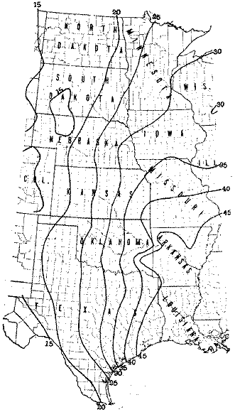
FIG. 5.--Average annual precipitation in inches.
|
112 |
|
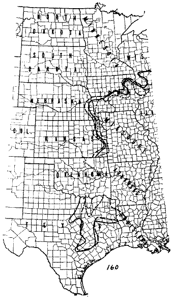
FIG. 6.--The movement of the 160-acre
lines. The dotted lines indicates the western margin of 160-acre
farming in 1880 and the solid line, the western margin in 1910.
 |
 |
 |
 |
© 2002 for the NEGenWeb Project by Pam Rietsch, Ted & Carole Miller