   |
Maps |
Guernsey County Government SiteGuernsey County provides this set of online township tax and plat maps. |
1895 U.S. AtlasThis atlas provides views of almost all U.S. counties, including Guernsey: 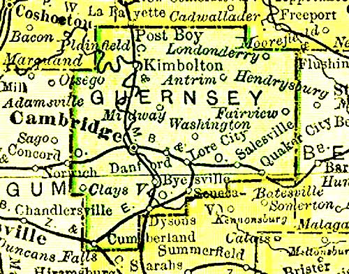 This map is part of a larger one of Ohio. The atlas is published on the web by the 1895 U.S.Atlas Project. which is part of the MARDOS Memorial Library. Thanks to Pam Rietsch for permission to post this map. |
Township Map of Guernsey County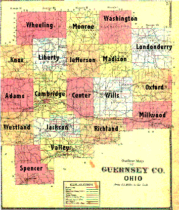 This map comes from Atlas of Guernsey Co., Ohio published in 1870 by C. O. Titus, 320 Chestnut Street, Philadelphia, PA. It was copied by Sandy Burgess from the original, inherited from Minnie Neel Bair. |
The Historical Development of Guernsey County and its TownshipsThis document recounts the creation of Guernsey County and its townships, and the changes to their boundaries that have occurred through the years. Included is an explanation of the three Ohio land surveys from which Guernsey County was formed. 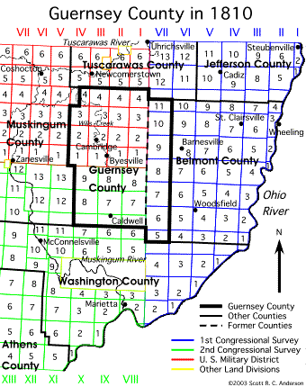 |
|
U.S. Geological Survey Topographic and Aerial Photographic Maps
Thanks to Denny Shirer for creating this form. |
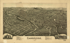 Panoramic Map of Cambridge, Ohio 1899
This panoramic or perspective map was drawn by T. M. Fowler . Click on the map at the right to view it at full scale, with zooming capability. It is published on the web by the Library of Congress. More details about the map can be found here. Thanks to Tom Severns for recommending this map. |
|
|